Littleborough
 Situated a short distance to the
west of the town of Rochdale, Littleborough is a
small town that, in the Industrial Revolution, found
itself at the focal point of development in the
Parish of Rochdale. The parish was made up of 5
townships and the small community of Littleborough
was located within the township of Blatchinworth and
Calderbrook. It sat beside the River Roch at the
point where the early pack-horse road began its
ascent over the moors to Halifax.
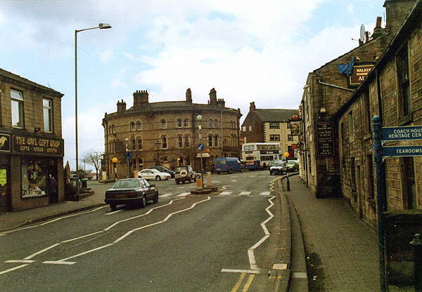 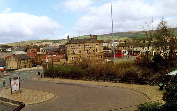 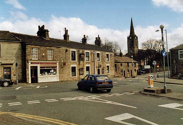 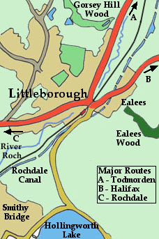
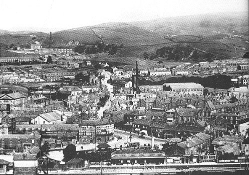
Unlike many other parts of Lancashire, the developing textile industry in the Rochdale area was more closely allied to the woolen production in Yorkshire. Trade over the Pennines was important but transportation routes were poor. Early routes involved a steep and dangerous climb over Blackstone Edge and clearly another route was required. 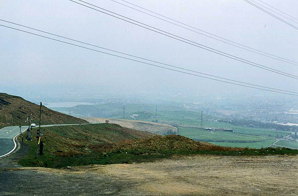 Littleborough sits at the mouth of a glacial spillway that was formed by the massive flow of water from retreating glaciers during the Ice Age. Today the River Roch flows in that deeply incised valley descending from the head of the valley near the village of Summit. Beyond the headwaters of the Roch the streams flow northwards to the River Calder. This system of valleys offered an ideal route first to the road builders. In 1758 an Act was passed for a road from Rochdale through Littleborough and up the valley to Todmorden. Remnants of those early days of road travel can be seen around the town. Below is the Toll House which guarded the Blackstone Edge Turnpike. 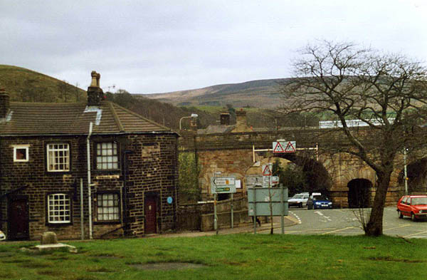 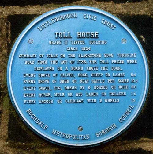    Then, in the late1790s, the valley was taken over by the builders of the Rochdale Canal who were pushing a route up the Calder from Sowerby Bridge to Todmorden and then south to Littleborough before turning west to Rochdale. The canal employed a series of locks to climb up to the summit before descending again into Littleborough. The canal was completed from Sowerby Bridge to Rochdale by December of 1798. 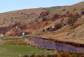 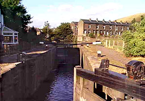 Three decades later the railway arrived. The first section of the Manchester to Leeds railway was opened at Littleborough Station on July 3, 1839. The railway's engineer George Stephenson was at the opening ceremony. 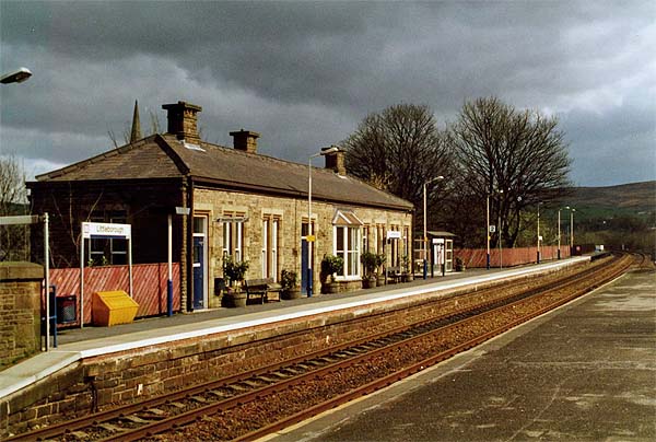 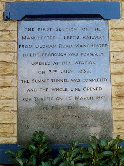 While this ceremony was going on, the valley to the north was once again a hive of activity as hundreds of workers were busy finishing-off the crucial Trans-Pennine link, the Summit Tunnel. 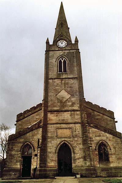 Throughout this period, Littleborough grew because of the building of the canal and the railway and as a result of the benefits flowing from them. The building of both systems brought an influx of construction workers. The presence of these transportation systems encouraged the developing textile trade, which was already progressing from the weavers cottages to the mills.    Littleborough was also close to the Rochdale Canal Company's Hollingworth Lake and it was one of the railway drop-off points for the thousands of weekend visitors who were attracted by this inland "seaside" resort in the middle of the 19th Century. The 2 images of the Rochdale Canal are shown with the permission of Martin Clark and come from his Virtual Tour of the Rochdale Canal web site. The image at the top of the page of the Littleborough Town Centre is shown with the permission of the Littleborough Civic Trust. The images of Littleborough Church and the Falcon Inn are shown with the permission of Jeff Mills. |
Close Window