|
Linley
House - Dickinson Street
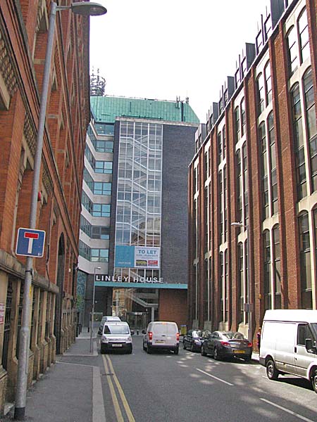 Linley House is a
building that you have to make some effort to see
since it is hidden in a sort of courtyard surrounded
by tall buildings. Only by looking down
Dickinson Street from Portland Street (see
above) or down Bloom Street from Princess Street are
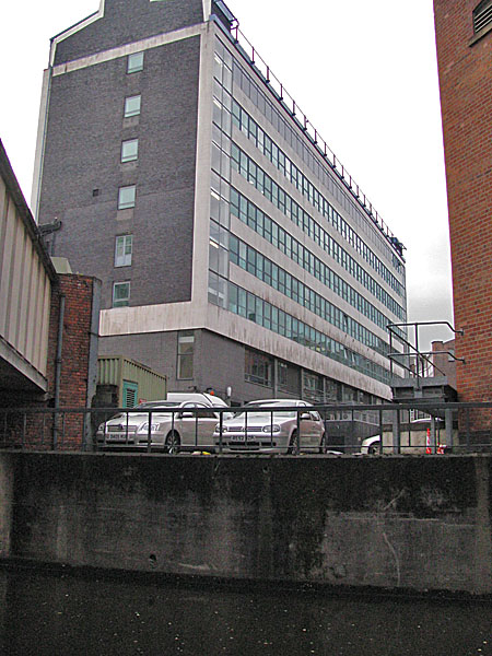
you likely to see it. The concrete and steel,
eight storey, curtain wall office building was once
the home to the North West Electricity Board. It
was built in 1963 by H. S. Fairhurst & Son.
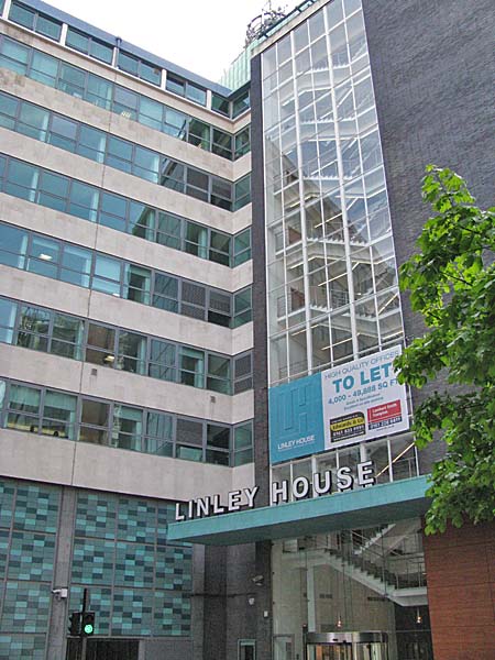 In 2010 United
Utilities Property Solutions, the building's owners,
announced that they had completed a £3.5 Million
refurbishment of the building. In May of 2011
floors 2 to 6 of the building were being offered "to
let". The letting agencies said that Cable &
Wireless UK were occupying the first floor and
Electricity North West were using the 7th and 8th
floors. Below you can see the view from Bloom
Street.
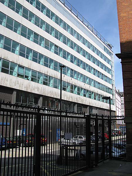 The old brick wall, in
the image below, is a remnant of the building that
once stood on this site.
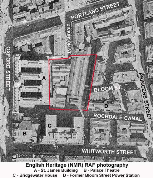
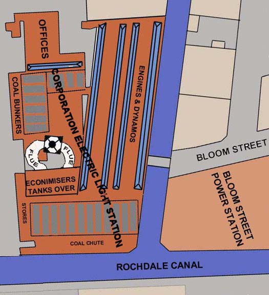
 Looking at an aerial
photograph of the site in 1953 reveals that the
present building's connection to United Utilities,
Electricity Northwest and its former connection to the
Northwest Electricity Board makes a great deal of
sense. This enclosed site was at that time
occupied by a large industrial building which turns
out to be the Dickinson Road Power Station. I
have outlined it in red. It was built in 1893
when it was the only power station serving the city
centre.
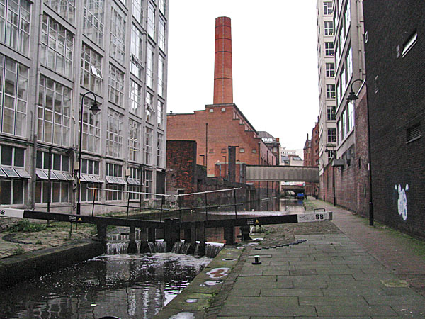
 If you look at the
aerial photograph above you will notice that a bridge
crossed the Rochdale Canal into the power station
site. That bridge is still there as you can see
in the image below.
 Access to the bridge was via a small stair tower located in Atwood Street (see below). It is also still there and on it is rusty plaque bearing the letters MCED, which I assume stands for the Manchester Corporation Electricity Department. 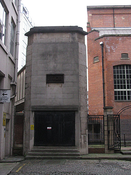 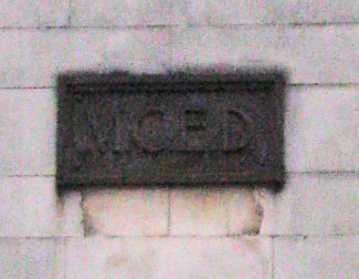 As you can see from
the map below, a spur of the Rochdale Canal ran
towards Portland Street in those days providing access
to barges bringing coal to the station. If you
click on the link below you can see an image from the
time.
Barges
at
the
Dickinson Street Power Station.
When it opened, the
plant consisted of 7 Lancashire Boilers and 10
vertical steam engines with belt drive
dynamos. Within four years demand had
increased so much that a new boiler house was added
with 10 additional boilers. Six of the small
generating sets were replaced by two large 2,500
horse-power engines.
 When the Dickinson
Power Station started work it served an area of about
half a square mile around the city centre but by the
mid 1890s agreements were drawn up to supply
electricity to a much wider area encompassing
districts like Moss Side, Withington, Levenshulme,
Gorton, Denton, Droylsden, Audenshaw, Heaton Norris,
and Failsworth. To address this increased demand
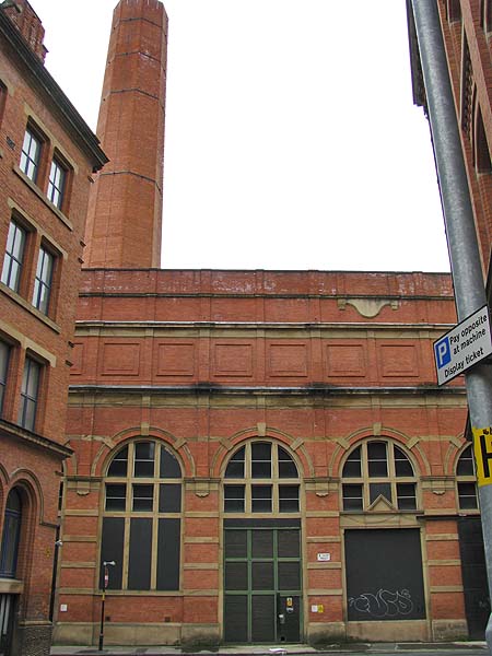
a second station was built nearby in Bloom
Street. Unlike the Dickinson Street Station,
which was demolished some time between 1953 and 1963,
its neighbour in Bloom Street is still standing,
although no longer generating.
 Combined Heat and
Power sites are all the fashion in 2011 but they
aren't a new idea. in 1901 steam pipes ran
from the Dickinson and Bloom Street Stations
taking the exhaust steam away to heat the Refuge
Building, the Palace Theatre and St. Mary's
Hospital. This apparently stopped in 1985
when Bloom Street closed.
 Before Linley
House was built, the canal spur that ran beside it
was filled in providing space for the extensive
car parking provision bragged about by the letting
agents. Today you can see evidence of this
branch of the canal. The concrete wall in
the image below, above which the cars are parked,
marks the spot where the canal once branched-off.
 Actually if you dig back a bit further you will discover that in the middle of the 19th Century there were two canal spurs running away from the Rochdale Canal. They created a peninsula, as you can see below. So before the power station was built, this peninsula of land was occupied by the Globe Iron Works, a timber yard and the Dickinson Street Cotton Mill. 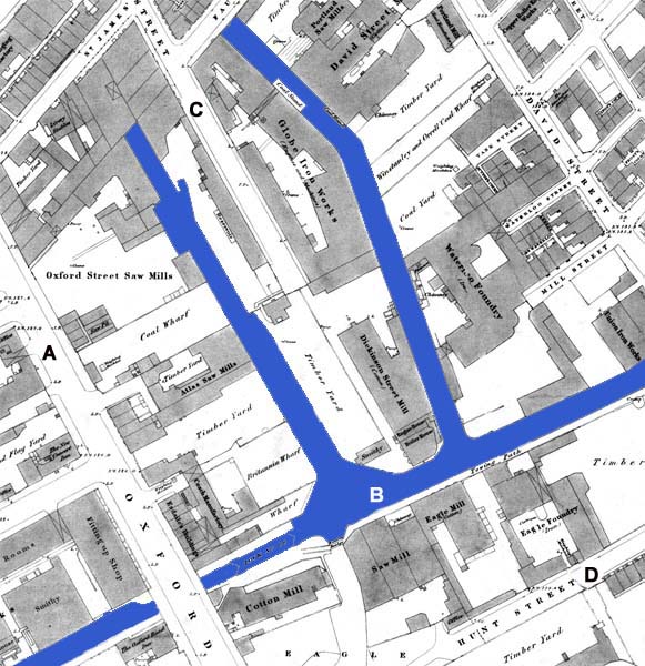
Close Window |