|
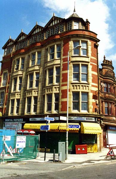
The
Britannic Buildings
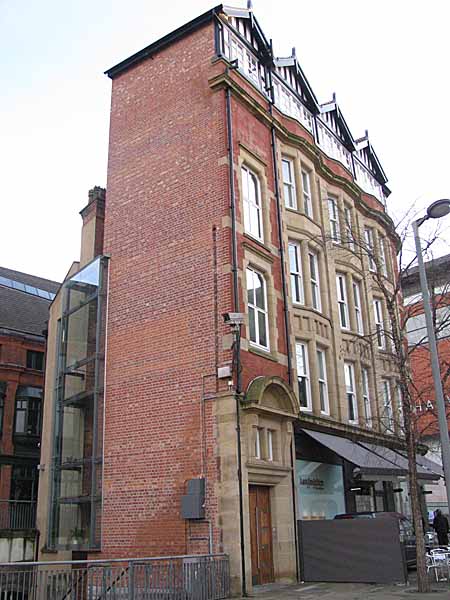  Britannic Buildings,
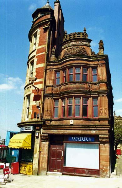
on Victoria Street, is attached to Mynshull's House,
around the corner on Cateaton Street. In the
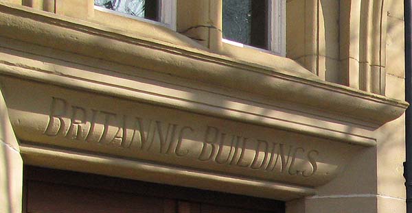
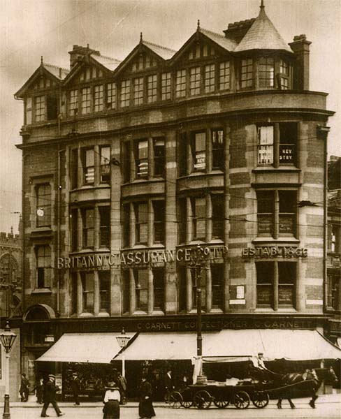
1927 Directory of Manchester, the Britannic Building
was occupied by the Britannic Assurance Company Ltd,
hence the name.
  This narrow, almost
d-shaped building with a half timbered top is a
rather odd combination of styles.
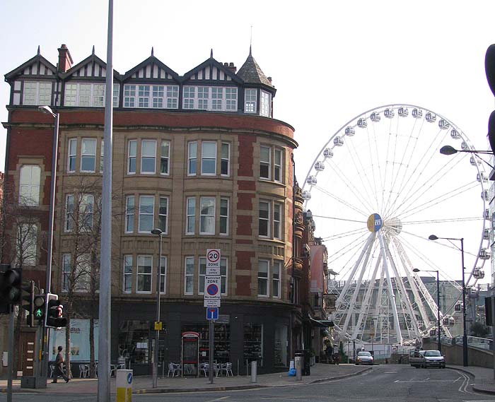
 The building that
you see in 2010 is the result of a significant
redevelopment. Here are two images of the
building during this transformation.
  The development
company, Nikel, that specializes in re-development /
regeneration projects, asked the architectural
practice of Harrison Ince to redevelop this red
brick and sandstone, five-storey commercial building
to create four unique apartments on the upper floors
and ground floor retail space.
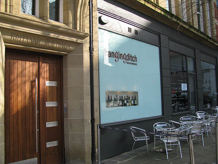
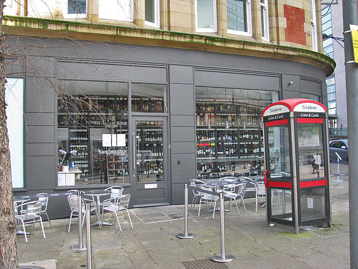
 The ground floor
occupant is the "Hanging Ditch Wine
Merchants". It was created by the
architectural practice of Stephenson Bell.
Their brief was to, "create a space that
showcased Hanging Ditch Wine Merchant’s extensive
wine selection and also satisfied the offering of
a wine bar and wine retailer. The challenge
faced by Stephenson Bell was to incorporate all
the necessary components into the 43 sq m ground
floor shop and 32 sq m cellar of the narrow
Victorian unit. The solution was to create a
“library of wine” shelving system along the entire
rear wall of the shop. "
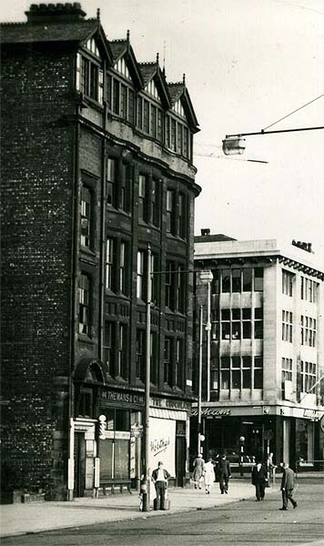
  The building looks
significantly different from the time the image below
was taken, in the 1960, before the Clean Air Act came
into effect, and before Manchester's sooty buildings
were cleaned.
 Below you see it in the 1980s after it had been cleaned. 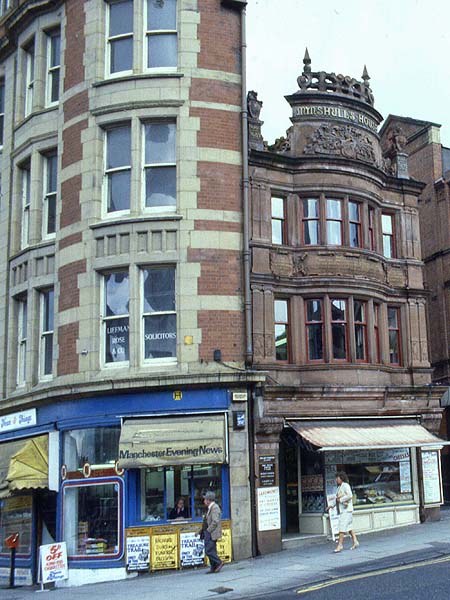 ********************************* The earliest maps of
Manchester show buildings on the site of the Britannic
Building. Below is the Casson Map, thought to
have been drawn circa 1620 (shown here with the
permission of Chetham's Library).
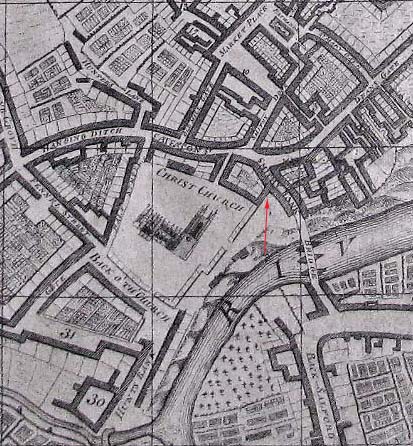 Today the streets are
aligned somewhat differently than shown in the map,
but the arrow points to roughly the position of
today's Victoria Street. You can see rows of buildings
adjacent to what was then Christ Church and is now
Manchester Cathedral.
The image below shows the site in the 19th Century. The exact date is unknown but the Cathedral does not have its west porch, which we know was added in 1898 by Basil Champneys, the architect of Rylands Library, so it was certainly before that. I think we can take it further back because the 1886 map of the area shows the site empty because the building, which occupied it, had been demolished. Cromwell's statue is in place and it was added in 1875. 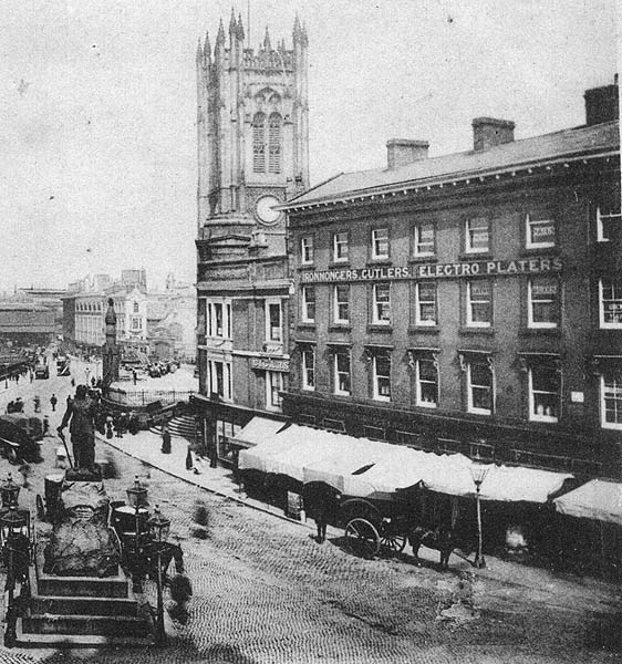 However, I think we
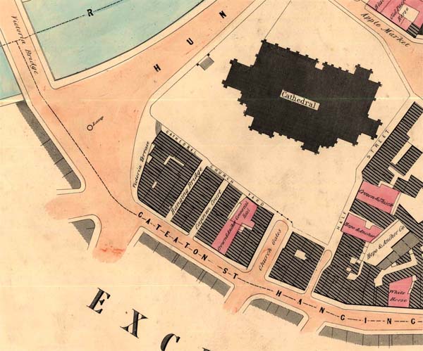
can take it back earlier than that. The Adshead
Map below, dated 1851, (show with the permission of
Chethams Library) shows the "Victoria Terrace" with a
flight of steps going up to "Cathedral Church Yard"
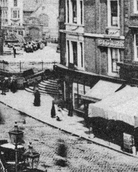
which can be seen in the image above and in close-up
below the map.
  The Slaters Directory
of Manchester & Salford has a number of listings
for Victoria Terrace indicating that it was a mixed
use building of retail and residence. At number
1 Victoria Terrace, Slack & Brownlow & Co were
selling "... improved water filters and
aquariums". Albert Perry was residing at number
2, Thomas Hammond at number 4, Mary Ann and Sarah Mawn
at 5, Benjamin Hardman Mawn at 7, and Henry Thomas and
Abraham Isherwood at number 8.
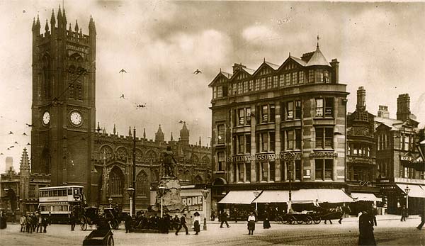
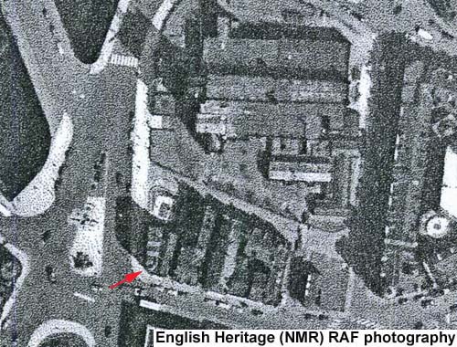
So Victoria Terrace was in place by 1851 and probably earlier. It was gone by 1886. I don't know when the Britannic Building was erected but the postcard image at the top of the page came from a card posted in 1914. The Britannic Assurance Company started in Birmingham and their company history says that they began to spread across the UK in 1905. So presumably, if the building was built for them, it must date from around that time. You can see the
building in the image below dated 1953.
 Close Window |