|
Southeastern Longsight
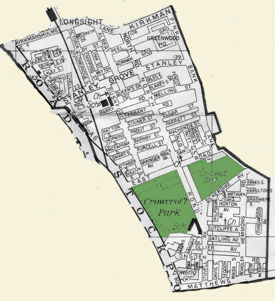 Technically, Longsight extends as far south as a line drawn along East Road, Pink Bank Lane and Nutsford Vale. Beyond that line is Levenshulme but I don't think that the residents, especially former residents of the area, would look at it that way. For many of the people who inhabited those streets in the block of land south of Stanley Grove and between Stockport Road and Pink Bank Lane their school was Crowcroft Park Primary and their recreation centered around Crowcroft Park and Longsight Cricket Club. So for the purposes of this site I'm setting the southern border as Mathews Lane. I did not live in this part of Manchester so I'm not going to presume to describe it in the way I did for the north-eastern section. I will point out its prominent features and take you on a virtual trip down some of its streets. If you want a taste of what it was like to live here, read Graham Todd's memories of Longsight on the Memories Page. ************************
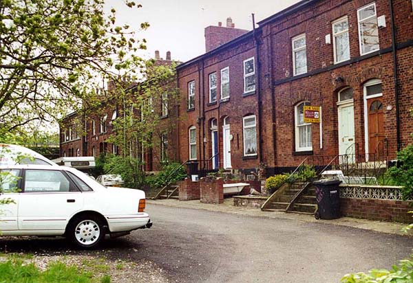
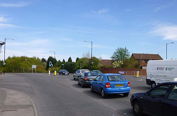
Kirkmanshulme Lane marks the northern edge of this area. This road has changed very little over the years. At the western end, where it meets Stockport Road, houses line the southern side of the road. 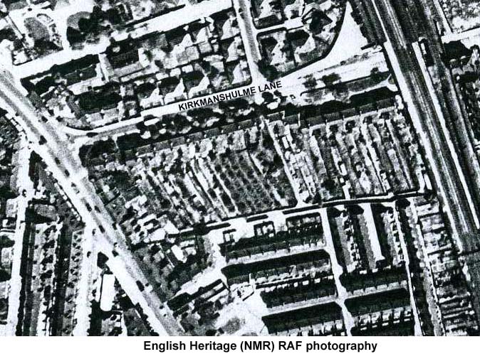 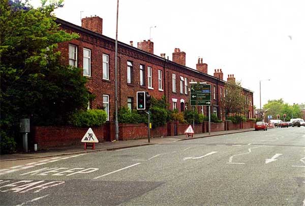 A terrace of homes with
extremely long narrow rear gardens reaches as
far as the access road to the Longsight Centre
parking lot. In the fifties this road did not
exist but it is located at the point where the
terrace of houses along the road ends and a
second terrace set back from the road begins and
runs to the railway tracks.
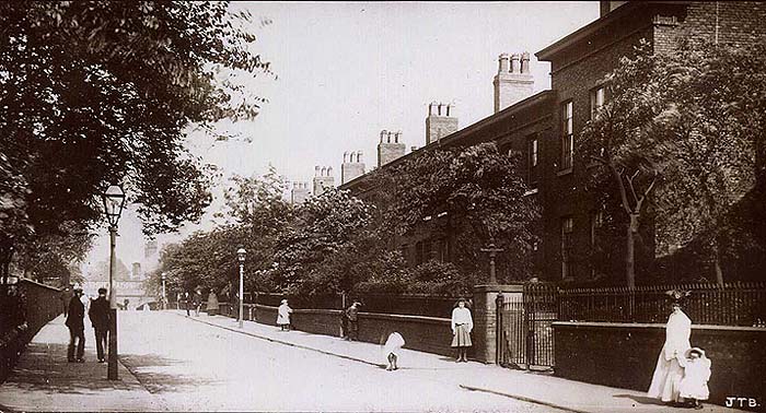
 As you can see from this
post card (generously donated by Dr. C. P.
Stewart.) the houses along Kirkmanshulme
Lane have stood in their present form for
many years.
 After
you drive under the railway bridge,
Kirkmanshulme Lane used to bear to the
right.
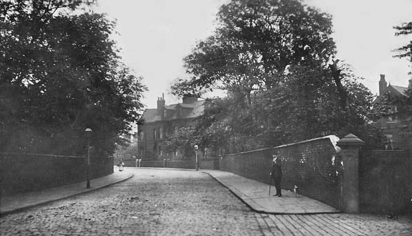 Today
it involves a right turn.
 On the corner with Pink Bank Lane in the 1950s stood Greenwood House. These flats were probably built in the 1930s.  You can see the flats on the right of the photograph below, donated by Les Cotton. They are in the background rising above the Longsight Entrance to Belle Vue. This picture was taken in the 70s. 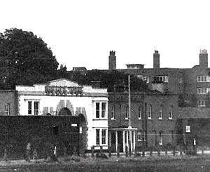 You
can see them below in these images
donated by Phil Auld. These
photographs were taken in 1977 just
prior to demolition.
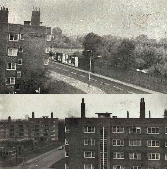 The small building in the centre of the complex is the washhouse. 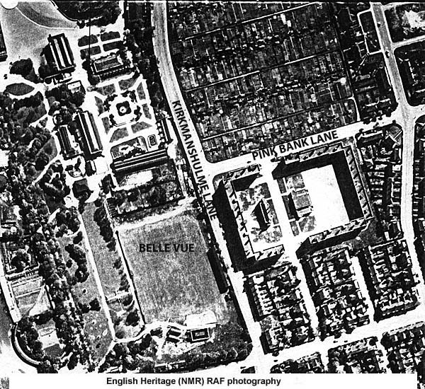 In 2014 this corner is occupied by St. Peter's Catholic High School. 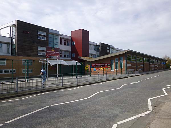 This part of
Longsight has a long industrial history
dominated by Jackson's Brickworks and a
number of other smaller
operations. Only fragments of them
remain. Further down Pink Bank
Lane you will discover Gorebrook Works,
once home to an engineering company but
today occupied by Papyrus, a company
dedicated to solving people's marketing
problems.
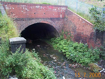
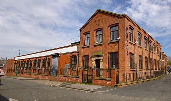 The factory gets its
name from the small river that flows
through Longsight for the most part
invisibly in a system of culverts.
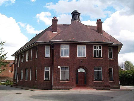
 There is little
evidence of the presence of Jackson's
Brickworks these days. Houses have
been built on the claypits and most of
the buildings are gone. However,
tucked away at the bottom of Pink Bank
Lane where it meets East Road the
company's office still remains.
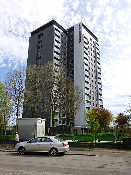
 East Road is also
home to Bickerdike Court, the only
high-rise residential block in the
district. It has been recently
refurbished and landscaped.
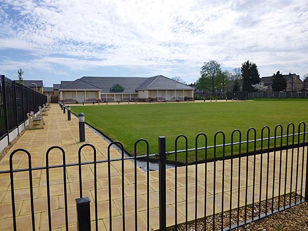
 Almost next door
is the Longsight Cricket Club or at
least what is left of it. The
site used to be home to a cricket
pitch and a lawn bowling club.
In recent years the cricket pitch
was used for a new housing
development and at the same time the
bowing green was preserved and a new
"pavilion" was built.
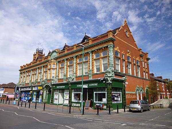
 At the heart of this
part of Longsight is Northmoor Road and
the prominent feature of that road is
the spectacular Beswick Co-op Building
which features retail units on street
level and an assembly hall above.
Among the occupants of the retail units
is the Northmoor Community Centre
 In the vicinity of the Co-op there is a collections of small shops. 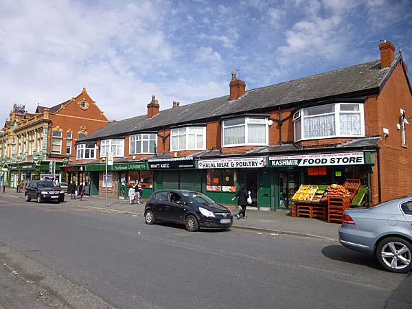  This is an area where terraced housing predominates. Here the strategy was to improve the housing stock not demolish it as they did north of Kirkmanshulme Lane. Extensive work has been done to make these streets safe again for children to play outside with a variety of traffic calming strategies. 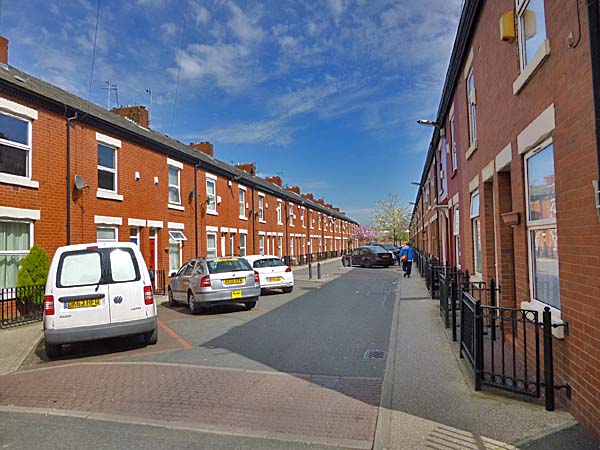 A short walk away
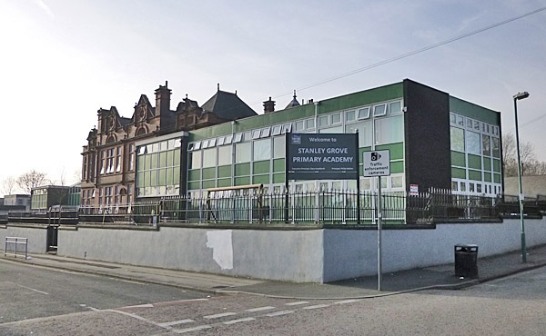
at the corner of Parry Road and
Rushford Street stands Stanley
Grove Primary Academy School -
formerly known as Stanley Grove
School.
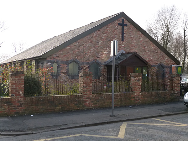
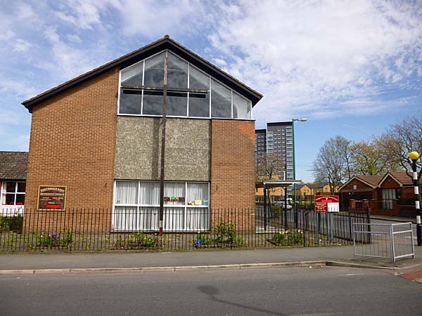
 Its neighbour to
the north on Rushford Street is
the United Church of God which
occupies a site that was once home
to St. Cyprian's Church.
 If you turn around
and head back south to the corner
of East Road and Northmoor Road,
you encounter Northmoor Church,
founded originally in 1911
and refreshed with a new building in
1959.
  If you cross over East Road you encounter Crowcroft Park and beyond it Crowcroft Park Primary School. 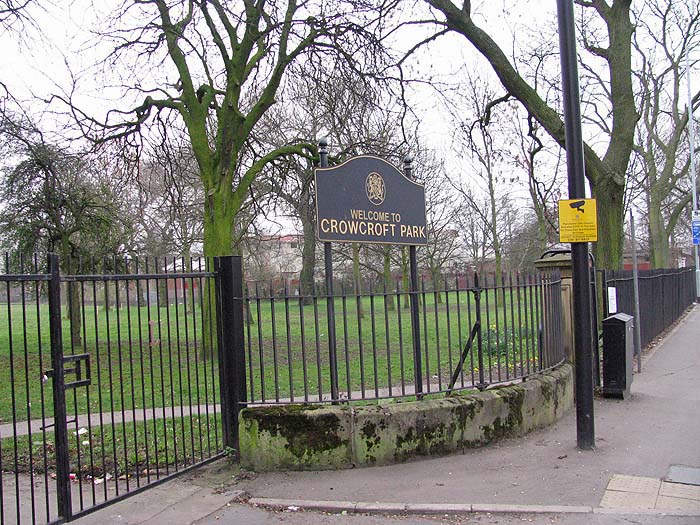 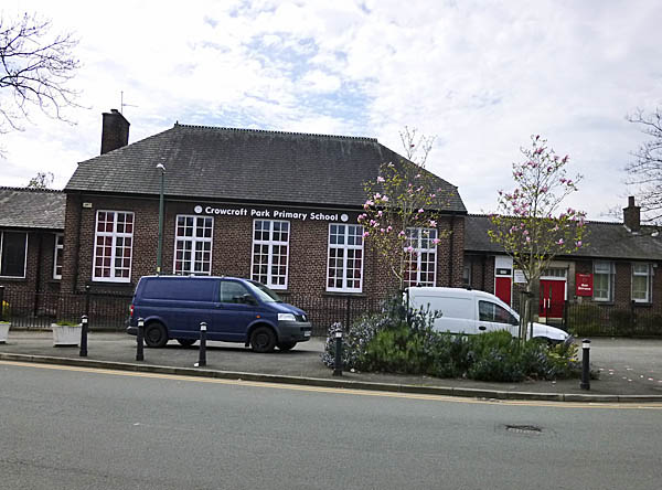 At this point we
have almost reached the furthest
point of my study area.
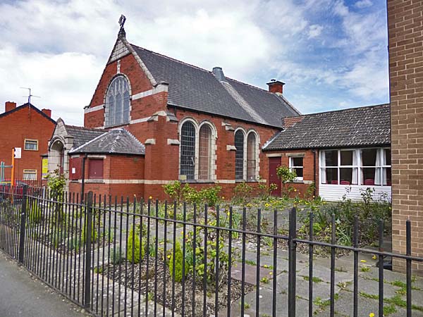
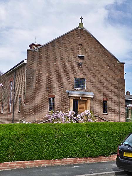
However, a little diversion
eastwards along Sutcliffe Street
takes us past St. Richard's
Catholic Church, founded in 1936
and still going strong.
 If you turn right
at the corner with Hemmons Road,
you will see ahead of you the
remnants on the United Coop
Laundry. The building is
truncated from its former size and
today it is home to a number of
small businesses.
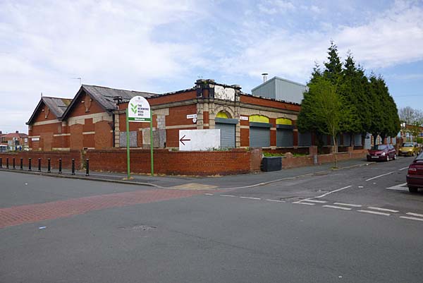 From here my tour heads back to Stockport Road and north again. Just before we reach Crowcroft Park there is a large building called the Jain Community Centre which is home to the Jain community in Manchester and beyond. 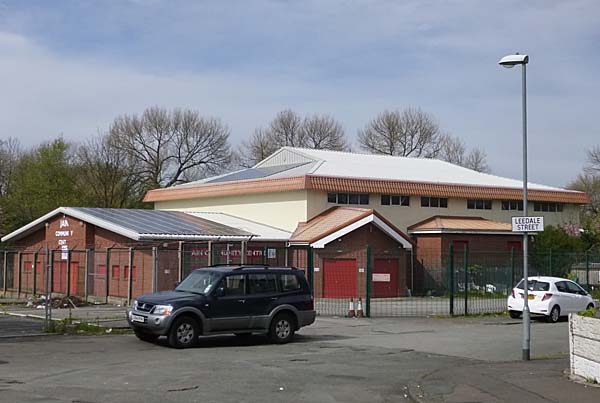 Exposing the
fact that we have in fact
strayed into Levenshulme at this
point, this was once the site of
the Levenshulme Palais de Danse,
shown below before its
demolition.
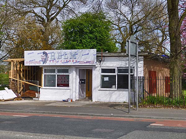
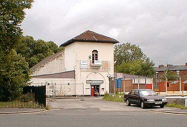 A little
further along the road, beside
the park, you will encounter a
small single-storey building
that has had a number of
commercial occupants over the
years but was in fact originally
occupied by the Manchester
Police because it used to be the
Crowcroft Park Police
Station. You see it below
in April of 2014 when it was not
at its best.
 Beyond Crowcroft Park you enter the retail section of Stockport Road. In the 1950s this was a busy area of large and small shops intermingled with pubs and cinemas. 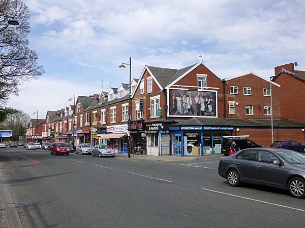 The Queens cinema once stood at this point beside the open Gore Brook. 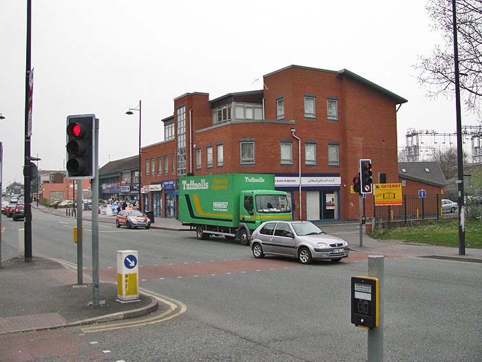 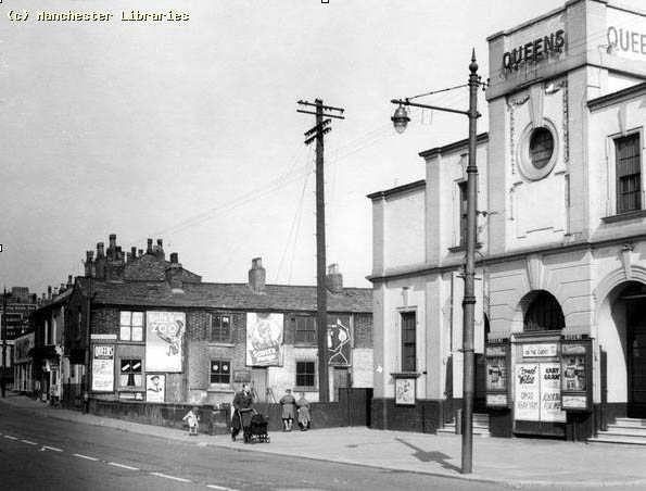 (The photograph above shows the Queens cinema. It is displayed here with the permission of the Manchester Archives and Local Studies Department) A side road
leads to the pedestrian tunnel
under the railway.
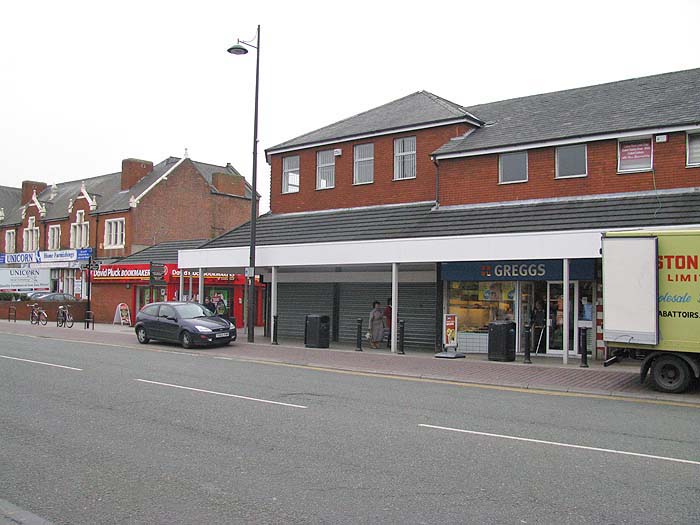
 As you approach the junction with Stanley Grove, you pass "farmfoods" which occupies the former Woolworth's store. You can see the art-deco facade behind the modern extension. 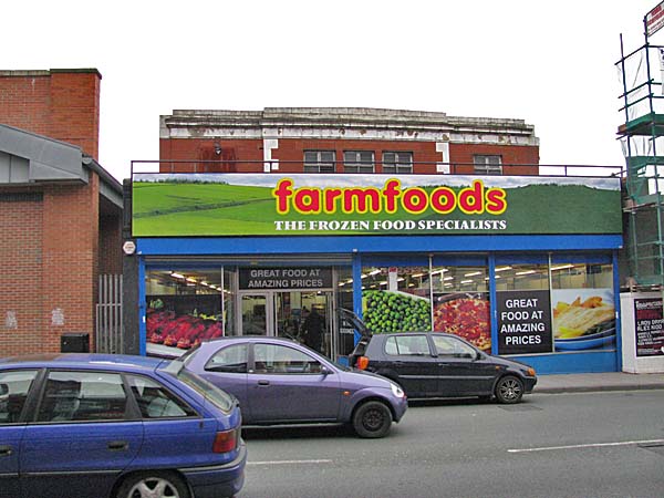 Today a Lidl store occupies the corner with Stanley Grove .... 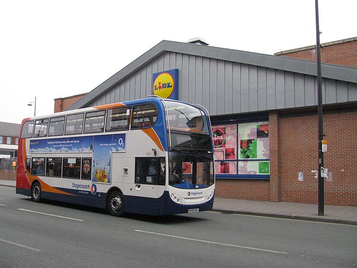 ..... which contrasts dramatically with earlier views of the junction. 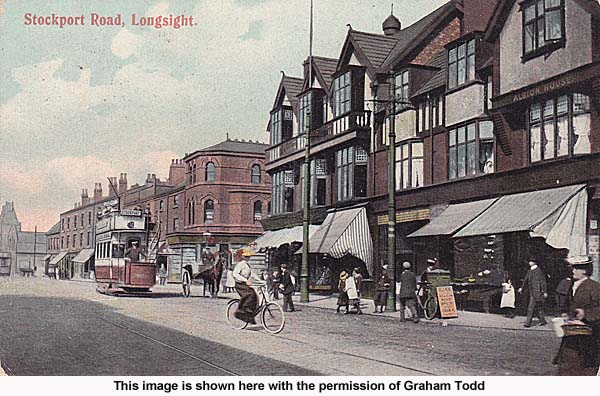 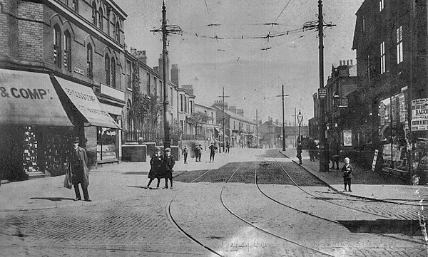 Moving
on towards Kirkmanshulme
Lane you pass the former
Church Inn (far left)
.....
 ....
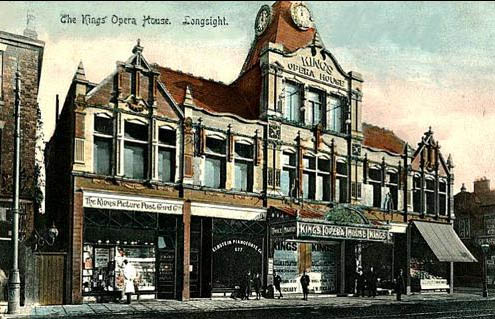
a local government
building that occupies
the site of the former
King's Opera House /
Cinema ...
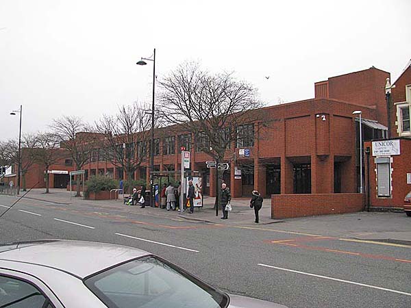  .... Longsight Library .... 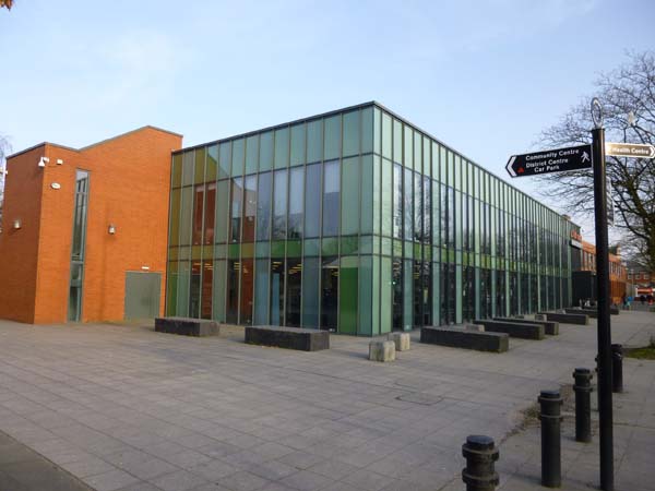 .... and finally the Pakistani Cultural Centre. 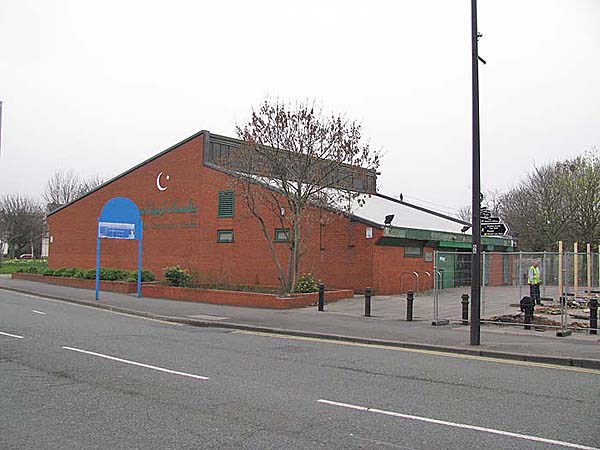 |