|
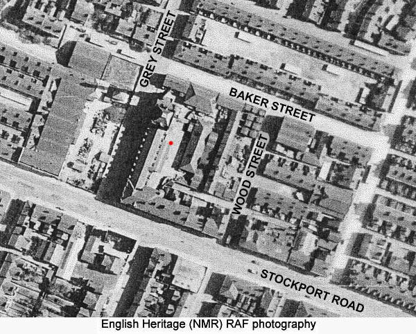
- 1950s - This area between Stockport Road in the west and Hyde Road in the east with Grey Street defining the northern bounday and Kirkmanshulme Lane the south, is today part of Ardwick. However, prior to the slum clearance of the 1960s and 1970s it was still Longsight. This almost triangular area was arguably the poorest and most run-down area of Longsight in the 1950s. Slum clearance started in the 1960s and resulted in the demolition of almost all of the houses, shops, pubs, churches and schools within this area. Prior to this it was really two communities on opposite sides of the railway. 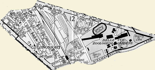 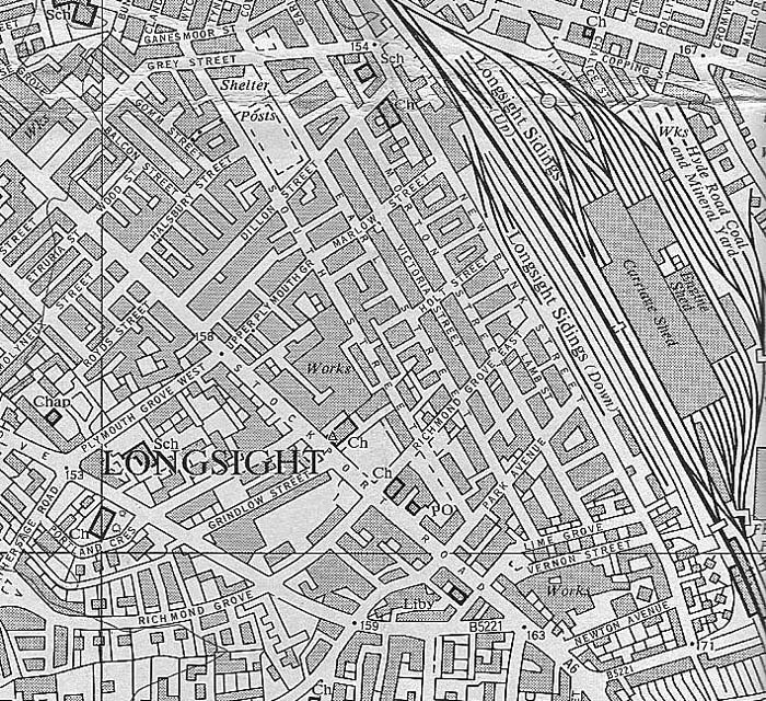 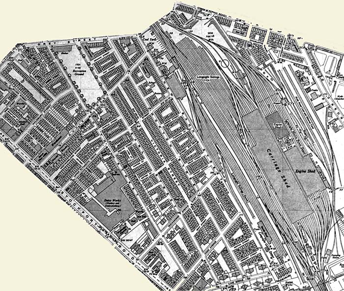 To the west, between the railway and Stockport Road, was a warren of terraced houses. At the beginning of the 50s most of the streets were cobbled but during that decade tarmac covered the cobbles. The exception to this was Morton Street, a long stretch of concrete. I grew up on Holt
Street which, apart from being the center of my world,
was in the heart of this closely knit community of
streets with their corner shops, chippies, and pubs,
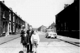
their churches and missions and back street bookies.  Photograph donated by Terry Mellor Above: Holt Street looking west - The shop on the left was Emmett's groceries and off-license. It
was
a
world
in which every one knew everyone else's business but
where everyone took care of their neighbours. A
world where the biggest worry you had was that
someone would break in and "do" your gas meter while
you were out. A place where kids played all day in
the streets, warned only that they must not play on
the grids in case they caught the fever. A place
where "tick" preceded credit cards and a trip to
"Pops" on a Monday kept the rent man or the clubman
happy for another week.
It
is
true
that
there was variety in these terraced houses. In
Florence, Holt, Cobden, Ernest and Edlin Streets,
they were typical two-up two-down houses. The front
door opened into the living room and the back
kitchen opened onto a flagged back yard which also
housed the outside flush toilet.
  Beneath the stairs was a cubbyhole that was often used to store coal for the fireplace in the front room. Upstairs were two bedrooms, the front one larger than the back. There was no hot water and in the 50's the one cold water tap often sat above a shallow brown sink known as a slopston. Our kitchen featured a wooden rack used for drying clothes. This wooden frame could be hoisted up on a pulley taking it close to the ceiling and out of the way. On New Bank Street and Morton Street some of the houses had bay windows and up on Earl Street and Richmond Grove some even had postage stamp sized front gardens with walls and gates.  Looking along Morton Street from Lime Grove circa: 1952 Picture generously donated by Trevor and Pat Little  Above: Richmond Grove with a cobbled surface. 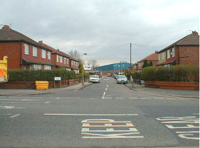 Further south on Park Avenue and Lime
Grove and on towards Kirkhamshulme Lane were
bigger houses. One that I remember had a wall
that was too high to see over and as kids we
believed that there was a pond with ducks in
there, something not common in the gray
streets around us.
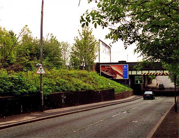
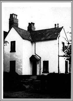 Ash Cottage on Lime Grove the home from 1937 until 1962 of the Butterworth Family. Picture generously donated by Trevor and Pat Little 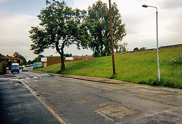 Above, New Bank Street looking
south towards Kirkmanshulme Lane. Longsight
Station would have been off to the left. The
trees mark the end of what was Lime Grove.
 Above,
New Bank Street looking north. The grass berm sits
where the houses on New Bank Street were
located.
 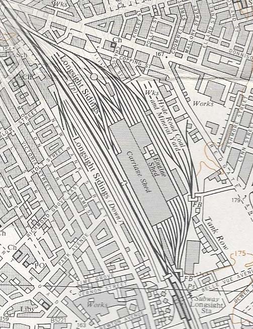 Longsight
Station was located just before the bridge
which carries the railway over Kirkmanshulme
Lane.
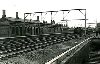 A
gradual ramp ran up to the station from
Kirkmanshulme Lane close to the junction
with New Bank Street.
  Between the terraces ran
narrow back entries which my Auntie called
"ginnels".
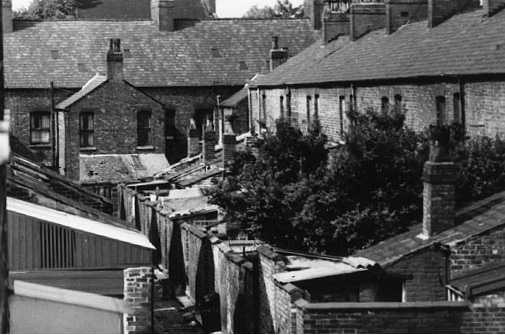 Picture above donated by Les
Cotton
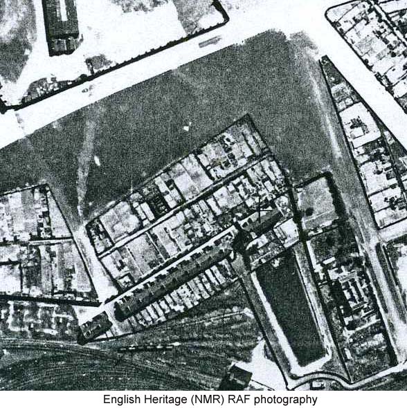
These were great places for games of hide-and-seek with little bodies pressed hard into back yard gates making them difficult to detect at the end of a long day away from the dim light of the street lamps. The streets that ran perpendicular to New Bank Street formed rectangular blocks and in the middle were small crofts of land which actually had scrubby grass but were often littered with discarded items. In WWII these "backs" housed air-raid shelters but they were long gone when my generation used them as a playground. 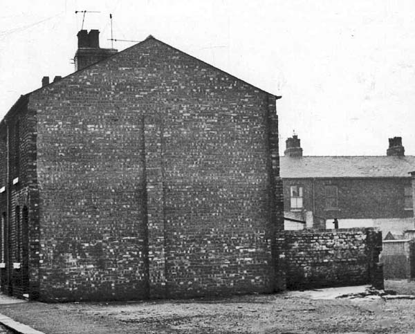 Holt Street also had a croft on the corner with New Bank Street where a pub had been demolished. It was also our playground, soccer pitch, cricket ground, bonfire location and on occasion dirt track for cycle races. The doors from the pub were "salvaged" and used to create wardrobes in the alcoves next to the chimney in the front bedrooms of Holt Street. A dominant feature of this part of Longsight was Pownall's Daisy Mill. The mill still sits on Stockport Road and looks much as it did in the 50s with the exception of the fact that its mill chimney is gone. 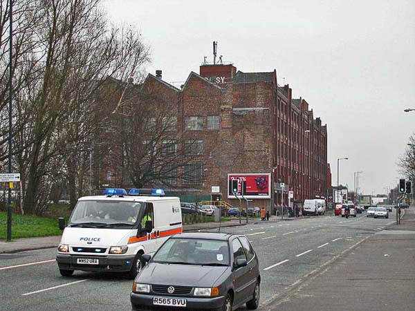 Behind
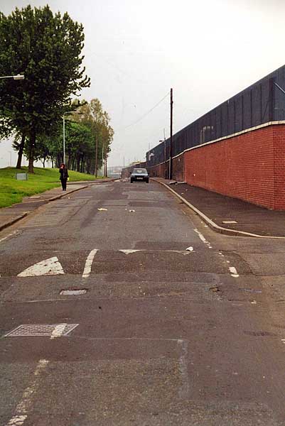
the Daisy Mill, South Street ran almost the
full length of the area.
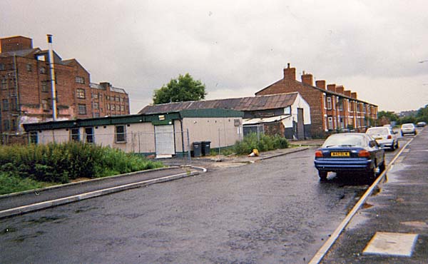 South Street 1999 -
picture taken by Bill Bullock
At its
mid point was the South Street Wash House ....
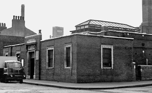 ...
and just beyond it, the famous Dutton's
Chippy. At the northern end was the
Sand Park sitting between Earl Street and
South Street with Grey Street not only
marking its northern boundary but the
northern boundary of Longsight. Cross
Grey Street and you were in Ardwick.
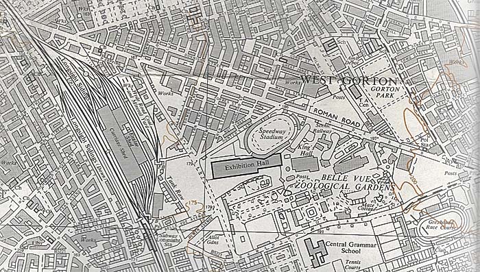
 Go underneath the railway at the end of Grey Street and you reached Hyde Road and beyond was Gorton. 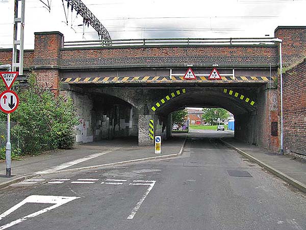 The second half of Northeast Longsight lay beyond the railway and here was Belle Vue Zoo and Amusement Park and some housing. 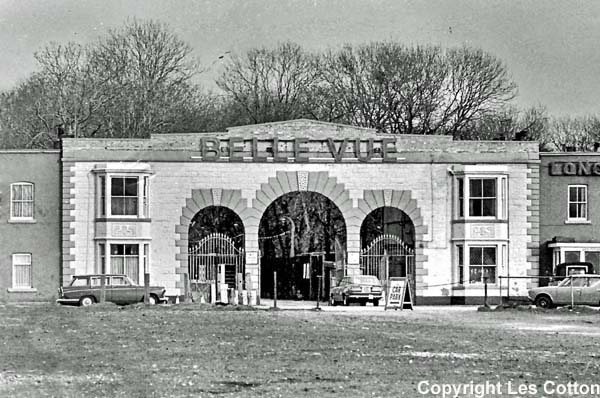 Belle Vue is shown within the red line on the aerial photograph below. 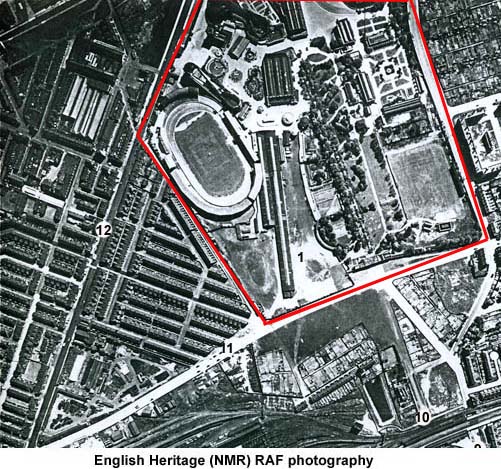 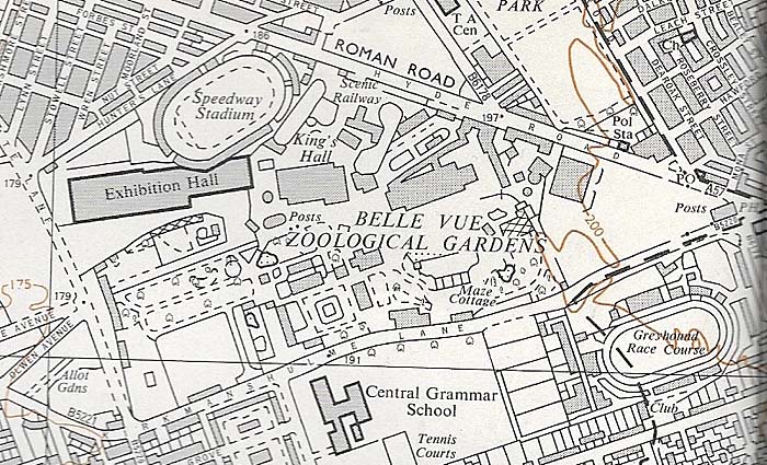 To the left of it,
near the number 12 on the image above, is a
triangle of terraced housing. This had
once been home to Belle Vue Prison.
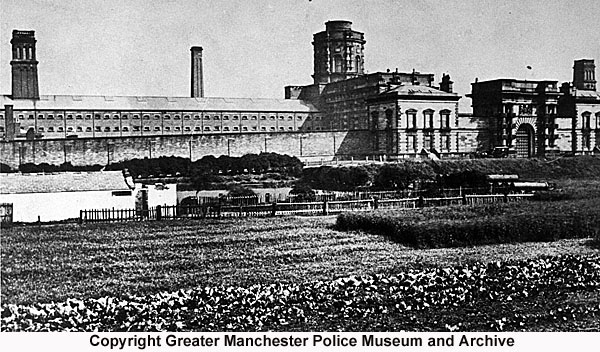 When the prison was
demolished, the houses were built on the site
and it was here that
John Thaw grew up.
 There was also a row of
railway houses, aptly called Tank Row, that
was located close to the railway reservoir.
 When Belle Vue was closed, a
Wimpy estate was built on part of the site.
Three of the streets were named after local
personalities. Lockhart Close was named
after George Lockhart, the ringmaster at
Belle Vue International Circus for many
years. Hoskins Close was named in honour of
Johnnie Hoskins who brought speedway and
stockcar racing to Belle Vue. Finally, Ellen
Wilkinson Crescent was named after Ellen
Wilkinson, also known as Red Nellie
Wilkinson, former student of what became
known as Ardwick Technical High School,
Member of Parliament for Jarrow, a leader of
the Jarrow March and at one time Minister of
Education.
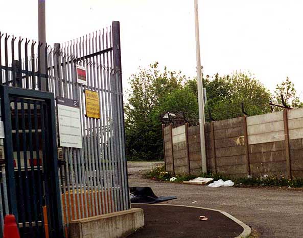
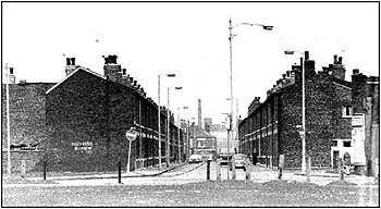
The picture below shows
the entrance to Ellen Wilkinson Crescent
from Kirkmanshulme Lane. Beyond, on the
right, you can see the Belle Vue greyhound
track. 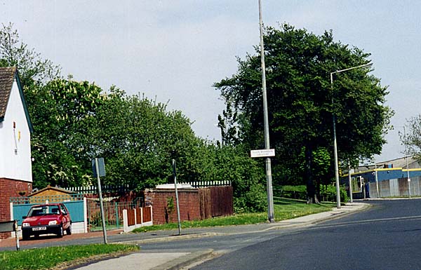 Among the other features of
this area in the 1950s, were:
the brewery that
became Sarson's Vinegar Works on Stockport
Road, indicated by the red dot on the aerial
image below.
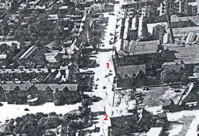
 Yates' Shirt Factory on Grey Street.  A number of churches
including the Wesleyan Methodist (1) and
Longsight Presbyterian (2), both seen in the
aerial photograph below.
 Longsight Post Office beside the Presbyterian Church on Stockport Road. 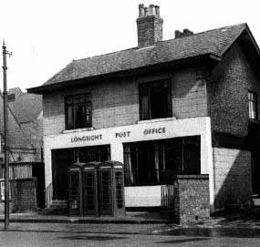 The corn mill on New Bank Street beside the railway indicated by the number 1 on the image below. 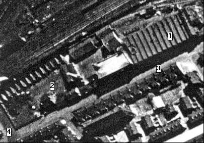 A tiny fragment of it remains in the form of a bricked-up entrance door. 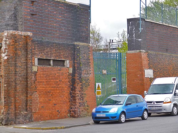 |