|
Marks
& Spencer plc and Market Place
 As a teenager I commuted daily between Old Trafford and Ardwick Technical High School in a time when buses still ran up Market Street. During the early 1960s I watched a new Marks & Spencer Ltd store being built on the corner of Market & Corporation Street. 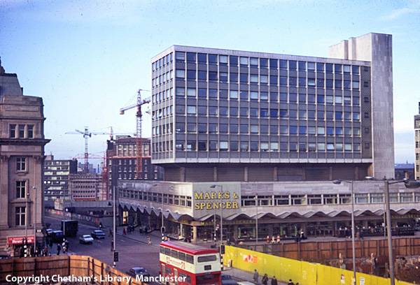 (The image above is from the Newbold Collection and is shown here with the permission of Chetham's Library.) It had a unique wave-formed canopy running around the building and later a footbridge that connected it to the Arndale Shopping Centre across Corporation Street. 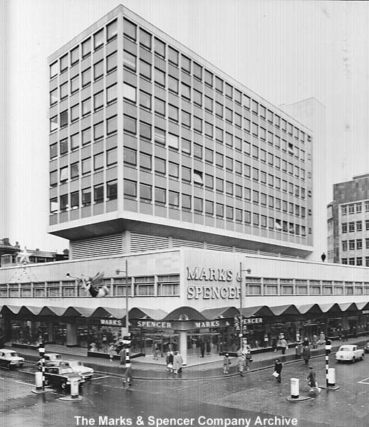 The image above is shown here with the generous permission of The Marks and Spencer Company Archive. 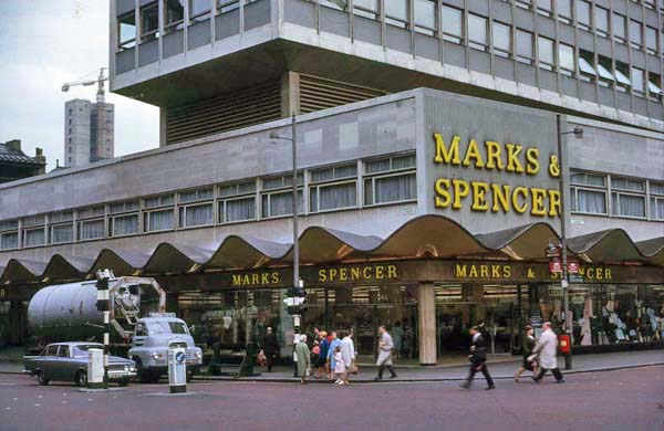 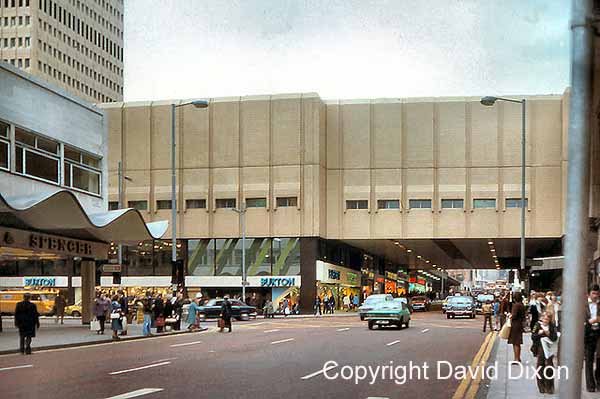 The images above and below are shown here with the permission of David Dixon. 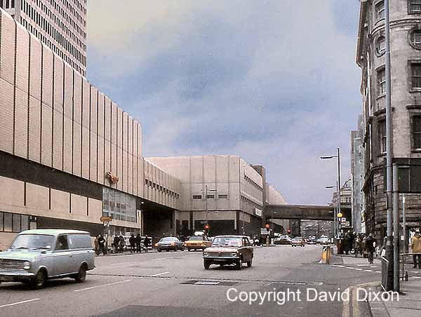 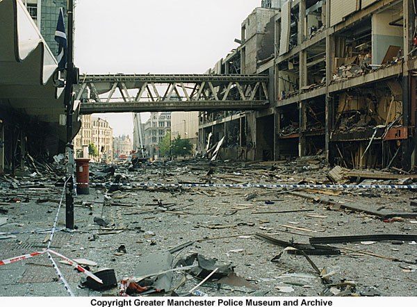 (The images above
and below are shown here with the permission of the
Greater Manchester Police Museum and Archive.
If you visit their Flickr
Photostream you can see other interesting
historical images.)
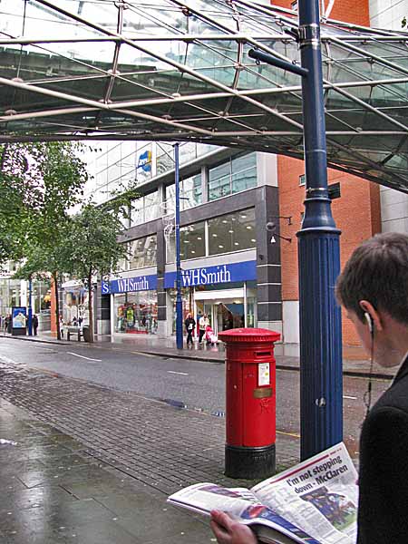
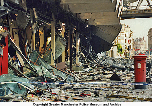 The van had been
parked beside the pillar box that you can see in the
images above. After the explosion it stood
undamaged and today it is still there beneath a new
footbridge. The pillar box has a brass plaque
that commemorates the events of that day in 1996.
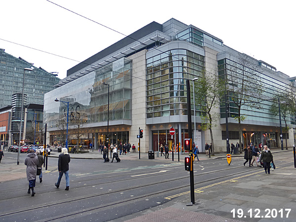
 *********************** In 1999 the new store
(seen below) opened for business.
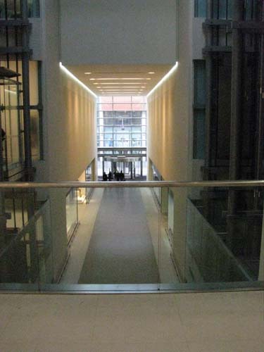
  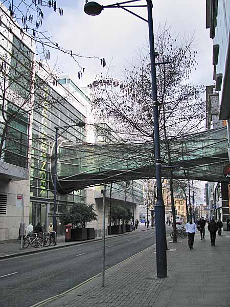 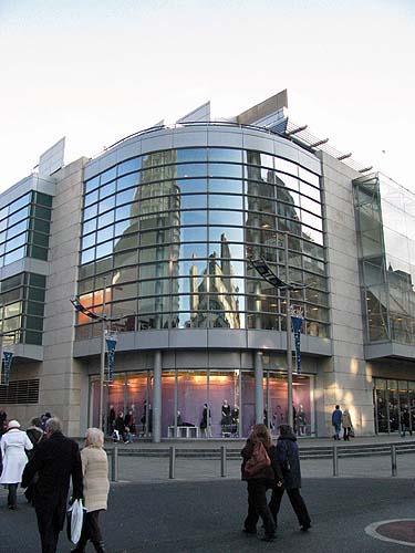  The new
building was designed by the Building Design
Partnership and it features a huge central
light well.
 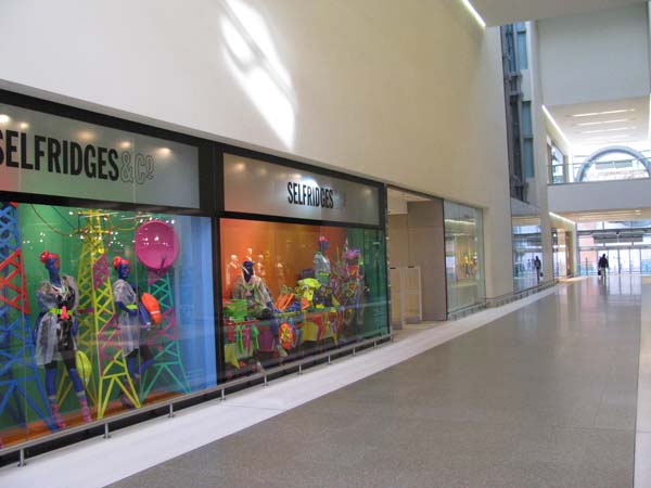 In 2002 the building was converted to accommodate a Selfridges store on the Exchange Square side of the building. ***********************
The History of the Site There
is a tendancy when you look at a new
building to wonder what it replaced, which
old building was demolished to make way for
it. What you often don't realize is
how many old buildings have stood on that
site, each one replacing its
predecessor. Sometimes the site itself
changed because streets were widened or
realigned. In the 1800s there was a
triving produce market located in the area
beside the present Marks
& Spencer plc (Company) store,
in an area that was known as Market Place.
The photograph below, shown with the generous
permission of Chetham's
Library, shows the market stalls arranged
along both sides of Market Place and the roof of
the Old Wellington peeking out from behind the
building on the corner. The buildings on
the right roughly occupy the position of the
present Marks & Spencer plc (Company) store.
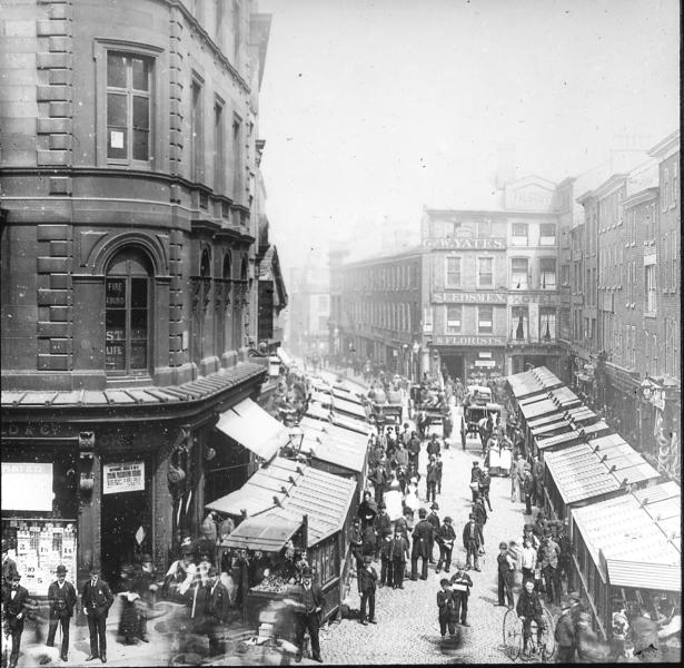 The Old
Wellington was the first building in this row
of medieval buildings. Ironically they
survived the Manchester Blitz in WWII and the
IRA bombing. The Old Wellington has been
moved twice and now stands not far away in
Exchange Square.
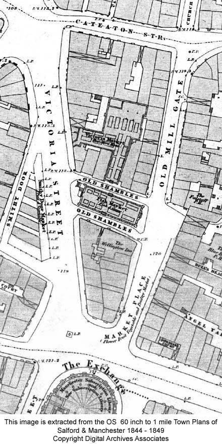
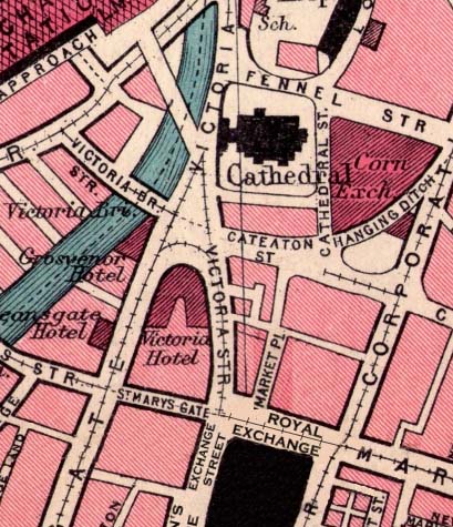
 The
OS map below, dated 1844, shows
Market Place running away from
Market Street and creating a rather
wide area which the map indicates is
the location of a "flower, fruit,
vegetable and poultry market".
I have also seen the street referred
to as Victoria Market. Beyond
the Old Wellington Inn, in an area
referred to then as The Shambles,
stood a fish market.
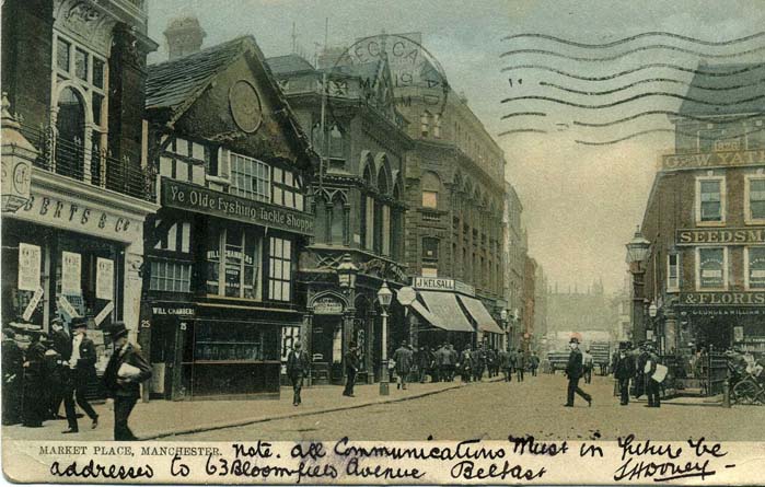
 The
photograph below shows Victoria
Street. The building numbered
2 is Sinclair's Oyster Bar at the
far end of the Shambles row.
The building numbered 1 must be the
one that housed the fish market.
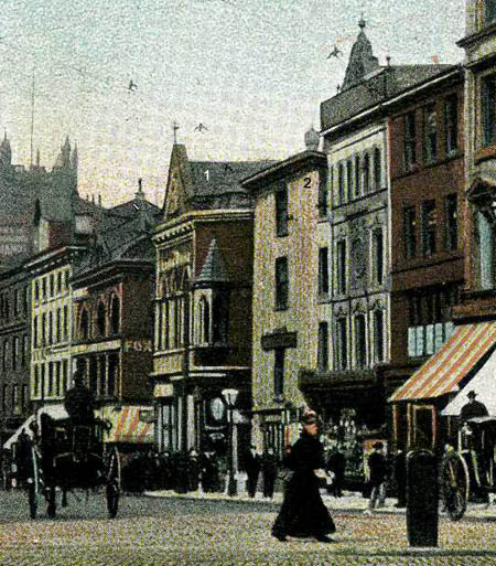 A review of the "Goad Maps Insurance Plan of the City of Manchester" shows Market Place in 1888 in much greater detail. Below is a sketch map I made based on that Goad Map. 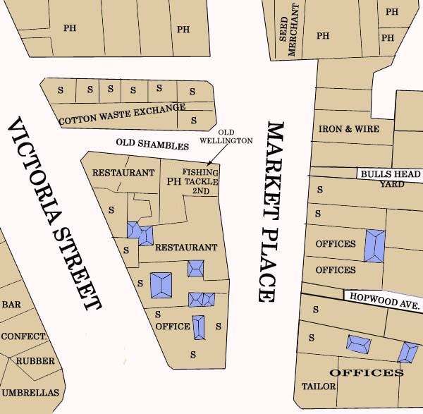 Above the Old Wellington Inn there is a Fishing Tackle shop which features in old postcards of the building. Where Market Place narrows and becomes Old Mill Gate, you can see a Seed Merchant shop which is shown in the photograph below. You can also see that the fish market has been replaced by a "Cotton Waste Exchange" and a series of shops. There is no shortage of public houses or restaurants in the area. The image below shows the southern corner of Market Place looking along Market Street. The Royal Exchange is on the right of the photograph. Today's Marks and Spencer store occupies the site of the block housing, among others, Beaty Bros Tailors. 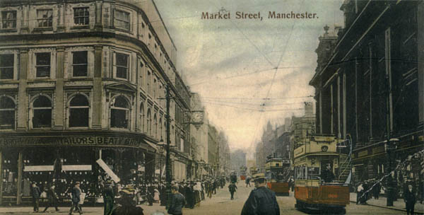 In 1935 Market
Place is still there across from the Royal
Exchange. (The map below is shown with the
generous permission of Eric Rowland the
creator of the genealogy web site - Artus
Genealogy Resources.)
 During the bombing in WWII large areas of the city centre were destroyed or so badly damaged that demolition followed soon after. So, fast forward now to 1953 and you can see the site in this RAF aerial photograph (shown with the permission of English Heritage). The building that stood on the corner of Market Street and Market Place is still there, as is the Shambles directly behind it. However, Beaty Bros Tailors has gone, as have most of the buildings that once stood on that block. For a few years after the war Manchester had a large number of outdoor car parks until the post-war redevelopment began. 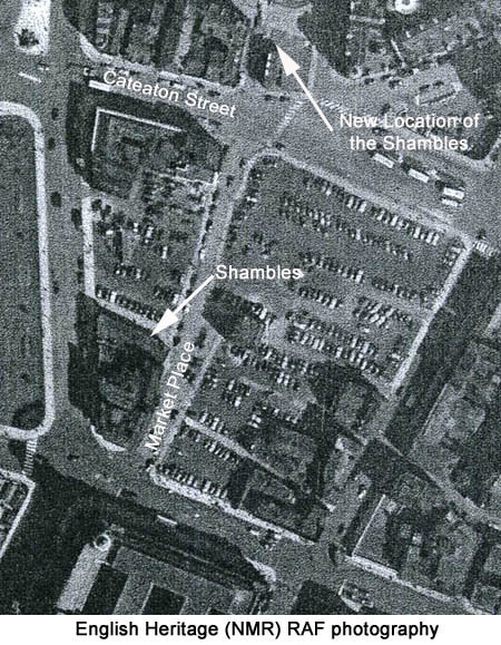 |