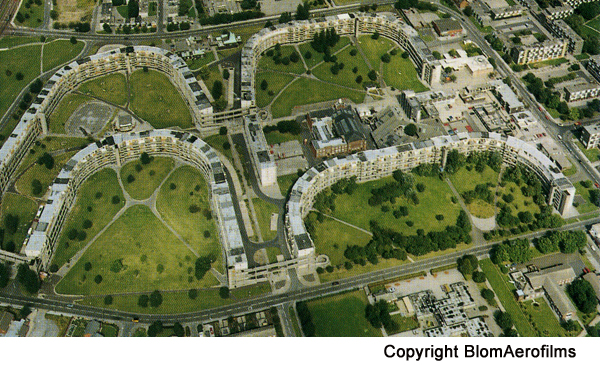
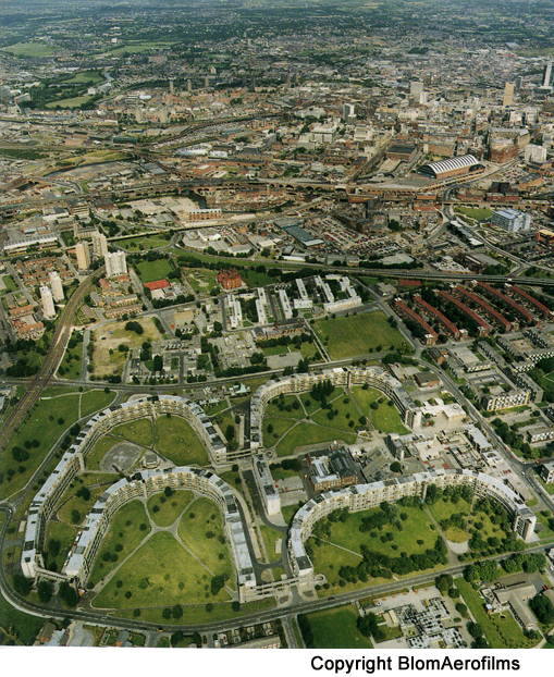
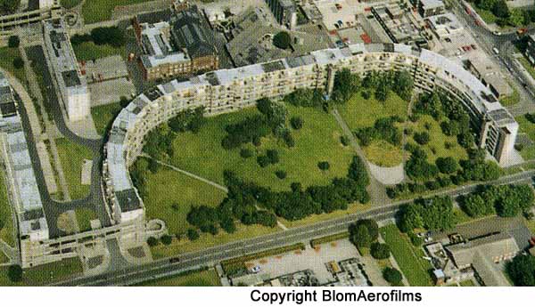
| The Hulme Crescents The Hulme Crescents
dominated the skyline of Hulme for nearly two decades
beginning in 1972. In their day they were one of
the largest housing complexes of their kind in
Europe. However, the Crescents are no more and,
to understand why they were built and why they were
demolished soon after, you need to know something of
the history of the area and of fashions in housing
architecture at that time.
*********************
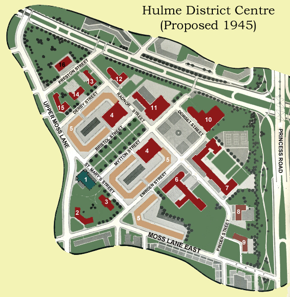
In 1945 the City of Manchester produced a plan for the reconstruction and development of the city. Among the many issues dealt with in that plan was the question of how the city was going to address the housing needs of its citizens. The 1945 plan said this about the state of housing in the city: “In many respects the Manchester citizen of 1650 was in a better position to enjoy a healthy life than the present-day inhabitant of Ancoats, Beswick or Hulme. If the quality of his house was poor, and the sanitary arrangements primitive or non-existent, at least he had a fairly large strip of garden and the open country was only a few minutes’ walk away. Today about 60 per cent of Manchester’s houses are built at densities in excess of 24 to the acre. Most of these 120,000 houses are old and must in any event be rebuilt in the comparatively near future. Over 60,000 are considered by the Medical Officer of Health to be unfit for human habitation.” The plan described the existing housing stock in areas like Hulme as, “Endless rows of grimy houses: no gardens, no parks, no community buildings, no hope.” 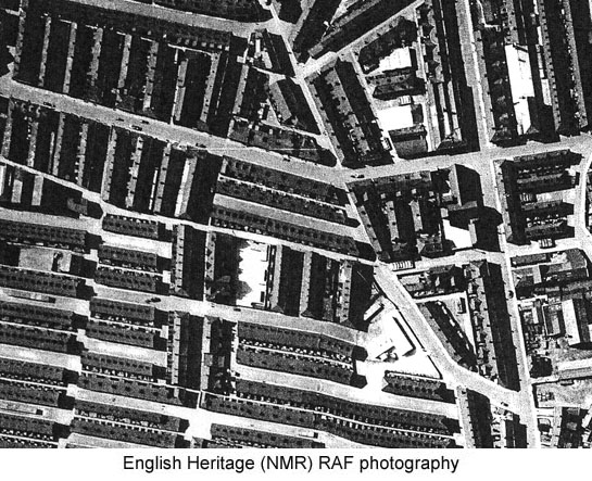 (Note: The image above is not of Hulme but is characteristic of the housing described in the 1945 Plan) The Plan called for the construction of new communities on the fringes of the city and the reconstruction of existing communities to provide the air and light that people needed and the green spaces, shopping and community centres that would make their lives better. The drawing below
shows the vision for Hulme's District Centre.
It was never implemented.
However, over the next two decades the city encountered one problem after another in trying to implement its plans. Attempts to build on the Cheshire fringes were opposed and abandoned, and although many people moved out of the inner city into Wythenshawe and Hattersley, it was clear that the solution would have to include clearing the existing housing stock and rebuilding. Manchester like other cities had turned to high-rise flats as a solution and had, in the 1950s and 60s, adopted many of the pre-fabricated building systems that were popular at the time. 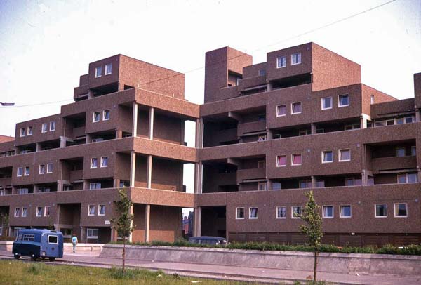 Above: The Fort Ardwick Estate However by 1967 the Manchester Housing Committee was of the opinion that, “dwellings must not be put into ‘office block’ arrangements.” The statement went on to say that they, “foresaw no building higher than a six-storey maisonette.” A year later the 23 storey Ronan Point Flats in London collapsed, “like a pack of cards”, killing 5 people and injuring 80 and that event threw a huge shadow over the tower block as a housing solution. *****************
So what happened next in Hulme was the collision of the need for a housing solution with the advent of a new style of civic building and the arrival in Manchester of the architectural partnership of Hugh Wilson and J. Lewis Womersley. Wilson had been the Chief Architect for the new town of Cumbernauld in Scotland. The original plan for Cumbernauld was for a new town capable of accommodating 50,000 to 80,000 people. Wilson assembled a group of planners and designers from around the world who saw this as an adventure in urban planning. Their plan called for, “a single multi-purpose town centre surrounded by high-density neighbourhoods. The neighbourhoods would not have their own retail centres, but would instead be connected to the main centre by pedestrian footpaths. Residents would be able to walk safely to and from the centre without ever coming across a car: a giant motorway system catered for those who wanted to drive through the town or to the centre.” What they created has been described by some as, “A soulless concrete carbuncle surrounded by roundabouts.” It is important to say that not everyone shares this view but it is relevant in relation to what happened in Hulme. J. Lewis Womersley was the Chief Architect for the City of Sheffield in the 1950s. He hired Jack Lynn and Ivor Smith to design the infamous Park Hill Flats. This huge complex was designed to replace the Park Hill slums and rehouse its residents in “Streets in the Sky”. Work began in 1957 and the walkways that provided access within and between the blocks were so wide that a milk float could still deliver to the doors of the residents. However, the paradise that was envisaged did not materialize and Park Hill became known as San Quentin reflecting the state of decay and crime that pervaded it. Park Hill still stands and after gaining listed status it is undergoing, somewhat controversially, a restoration/reconstruction by Urban Splash under the supervision of English Heritage. Wilson and Womersley arrived in Manchester in the 1960s when the Victoria University of Manchester and the City Council commissioned them to draw up a plan for the development of the university and hospital quarter. As part of this project they designed the Precinct Centre on Booth Street. 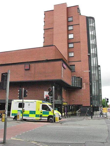 In 1972 work began on
the Arndale Shopping Centre which they designed.
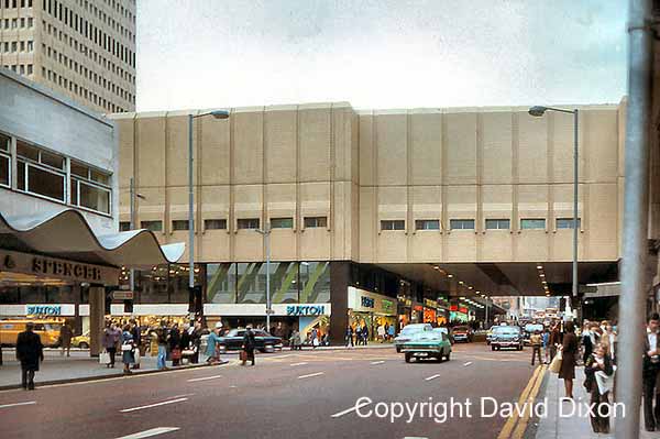 The image above is shown here with the generous permission of David Dixon In 1965 Wilson
& Womersley had submitted a plan for a £4
Million redevelopment of Hulme which as John J.
Parkinson-Bailey explains in “Manchester - An
Architectural History” involved:
“thirteen tower blocks; low-rise concrete blocks
clad in a variety of materials, and connected
together by aerial walkways; and the crescents -
four long, curved, south facing blocks of flats
and maisonettes connected by walkways and
bridges.” The Crescents sat astride
Stretford Road which had once been a vibrant
shopping corridor. By 1972 “over
5,000 new houses had been built in less than
eight years and over 3,000 of these were deck
access.”
Wilson and Womersley
believed that their design for the Crescents would
see the recreation in Hulme of the grand crescents
of London and Bath and to reinforce this they named
them after the architects Adam, Nash, Barry and
Kent.
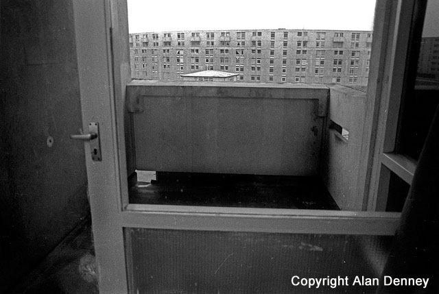
The four black &
white images below of the Hulme Crescents are shown
here with the generous permission of Alan
Denney
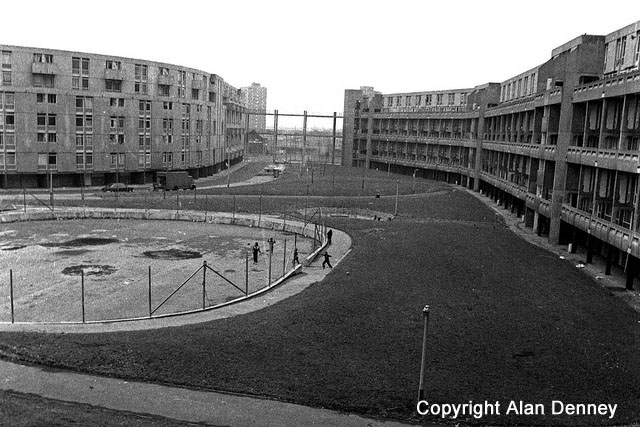 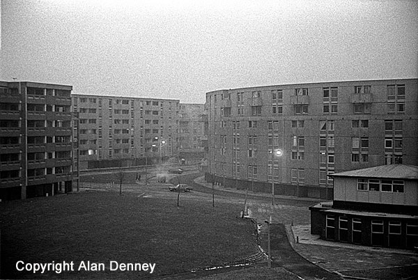 However, it didn’t
take very long for things to go wrong. Shoddy
construction resulted in the Crescents leaking.
The underfloor heating system proved to be expensive
to use and the leaking problem combined with
inadequate heating resulted in extensive condensation
problems.
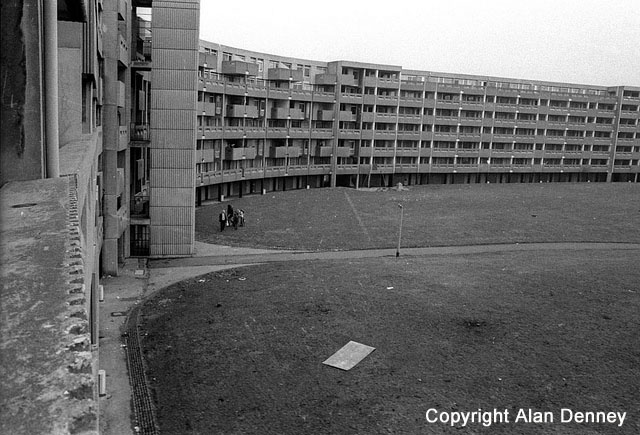 The buildings were
infested by cockroaches and mice that found the
ducting for water and wiring their own “streets in the
sky”. Three years after they had moved in, 96.3
per cent of the residents wanted to leave. The
lifts rarely worked and vandalism and indifference saw
the Crescents become unsanitary and unkempt. The
walkways provided perfect venues for crime and ideal
escape routes for criminals. Residents found
themselves hostages in their own homes.
 Less than 20 years
after they had been built, the Crescents were
demolished as a first step in a complete rethink of
Hulme as a community.
Close Window |
