|
Below you will see a
description of each section of the road. If you
click on the link below each section it will show you an
image from the Manchester Central Library
Collection. Note: This involves accessing
the Library site and sometimes it isn't available.
Once you see the opening page you can click on the image
to increase its size.
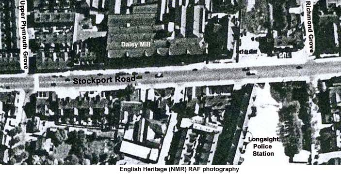
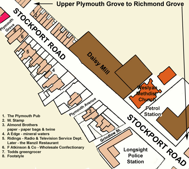
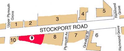
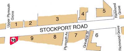
Upper Plymouth Grove to Richmond Grove - East Side 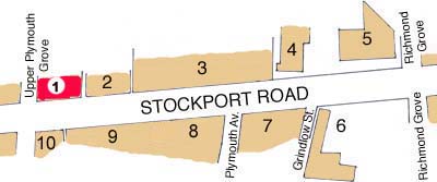 In this first terrace of
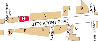
shops from Upper Plymouth Grove was the Plymouth pub; W.
Stamp, the butcher and Shelmerdine's the baker.
Here was the zebra crossing I used 4 times a day going
back and forth to Plymouth Grove School.
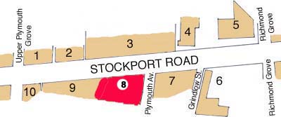
******  The second block along the road was a rather Gothic looking building with spires on either end. Five small shops were located at street level. ****** 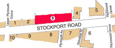 The prominent
building along this stretch of Stockport Road was,
and is, the Daisy Mill, formerly Pownall's Daisy
Mill.
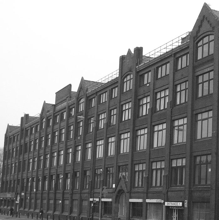 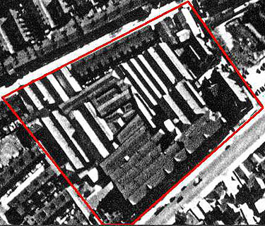 Originally a cotton
mill, the mill suffered a fire in 1928 but the
damage was repaired and it continued to operate
until 1939. During WWII the mill was used by the War
Office as an Army Pay Corps Depot. After the war the
building once again returned to commerce in the
garment industry. Many local women were employed as
machinists.
****** 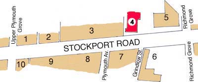 Wedged between the
Daisy Mill and a garage was the Weslyan Methodist
Chapel. It was demolished and at the moment is
the location of an Islamic College that is under
construction.
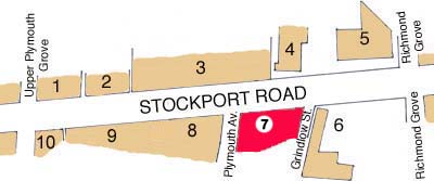
****** 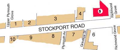 On the corner with
Richmond Grove was a garage and used car and
caravan sales lot. Over the following
decades various car lots and garages replaced it.
****** Richmond Grove to Upper Plymouth Grove - West Side 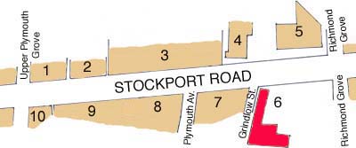 The Longsight
Police Station occupied a building that used to be
a Boys' Industrial School on the west side of
Stockport Road on the corner of Richmond Grove.
  In the 1930's
industrial schools were abolished and Manchester
Education Committee took over the building. At the
outbreak of war, however, the building was
requisitioned by the Auxiliary Fire Service and by
1941 had become Number 17 Area Training College
for the National Fire Service. First aid, rescue
and fire fighting were all taught there during the
war. My mother cleaned house for Mrs.
Mitchell, who was the head cook in the station
canteen. I went in there to see her and I
also visited one time when I found a wallet on
Stockport Road with a few pounds in it and I
handed it in. No one claimed it and I was
handed the money. The police station has
been demolished and replaced by a new one on the
same site.
******  From Grindlow
Street to Upper Plymouth Grove the road was
dominated by large houses that were originally
owned by a dentist, a music professor, a
carriage proprietor and a number of
merchants. By the 60s most of the houses
had been converted into commercial properties
including Almond Brothers Paper Bags and Twine.
******  Here were
houses that had once been grand homes but by
the 60s had seen better days. A building
that looked like a large garage was Edge's
Mineral Waters.
 ******  Once again
grand houses that wouldn't have looked out
of place in Victoria Park and obviously
graced Stockport Road when trams ran back
and forth. Whilst some contained
flats they were mostly commercial
properties by this point in time.
******  At the end
of the row of old houses one is occupied
by Ridings Service Centre. Later it
was replaced by the Manzil
Restaurant. A lower block stood on
the corner with Plymouth Grove West.
It included F. T. Atkinson's Wholesale
Confectioners and later Todd's
Greengrocers. Beside it was
Footstyle's Shoe Shop.
****** |