|
In
the second half of the 1800s when Victoria Park was
planned and developed, it fell almost entirely within
the township of Rusholme. Today, the western half of the
park is represented on the Manchester City Council by
the 3 councillors for Longsight. Once the building tie
was broken in the park, further development,
specifically the building of terraced housing, followed
soon after and it was in the south-east area
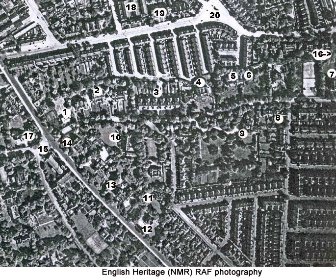
particularly that this happened. As you can see from the
aerial photograph below, the familiar grid-iron pattern
of terraced houses was the model followed by the
developers of this land. However, unlike the 2-up 2-down
cottages of the area between Stockport Road and the
railway, the terraced housing in Victoria Park was
somewhat more selubrious. 
The
eastern half of the park included some of the larger,
original homes and other structures dating back to the
last century and the early years of the 20th
century. A n umber of the buildings have been
located on the aerial photograph below. For
information on any of them, click on the corresponding
number in the table below.
|
|||||||||||||||||||
|
|
|
1 | 2 | 3 | 4 | 5 | 6 | 7 | 8 | 9 | 10 | ||||||||
|
|
|||||||||||||||||||
| 11 | 12 | 13 | 14 | 15 | 16 | 17 | 18 |
19 |
20 |
||||||||||