|
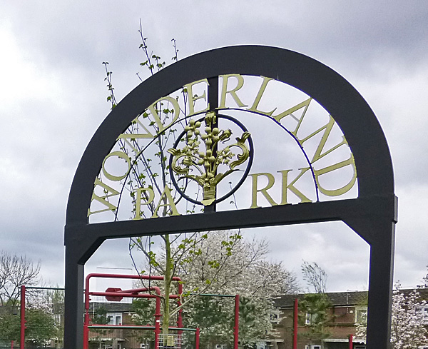
In 2014 a new playground opened in
Ardwick with the exotic name of Wonderland Park.
For a person like me who grew up in the area as a
child of the 1950s it brought back memories of an
earlier park on that site that we knew as the "Sand
Park".
 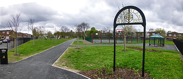 Wonderland Park was created from a
grass covered playing field with funds from a number
of sources. An article on the Guinness
Partnership website explains that, "... The
total renovation cost of £140,000 has been raised
by Coverdale and Newbank Community Association
with support from The Veolia Environmental Trust,
who have awarded £85,677 through the Landfill
Communities Fund, and Manchester City Council, who
also own the land, who have awarded £55,000. Local
housing providers Guinness Northern Counties,
Contour Homes, Eastlands Homes and Forbes
Solicitors have also provided funding and
support."
******************************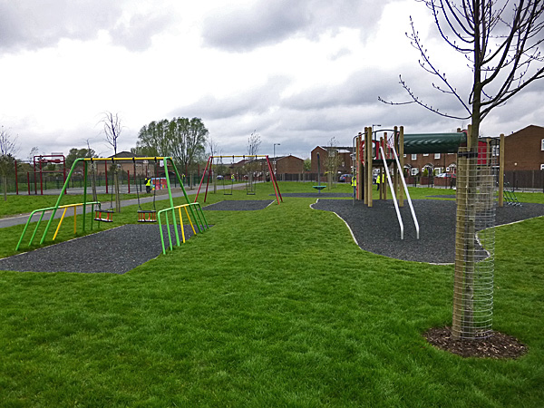 Local young people were involved in the design of the new park and their agenda included, "... special play areas created for under 5s and 5 to 11 year-olds, a new multi-purpose all-weather pitch, shelters, new pathways, lighting, refuse bins, tree planting, a wildflower meadow and new seating." The Sand Park When I lived in Longsight in the
1950s, Ardwick began at Grey Street so the Sand Park
was in Longsight. When it was officially opened
in the 1950s it occupied basically the same site as
Wonderland but it was divided into two definite
sections. At the Grey Street end was a "shed", a
shelter large enough to play a game of football under
if it rained.
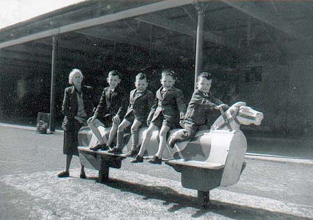
 (The image above was taken in the 1970s) There was also a playground with a red shale surface much like a clay tennis court - hence the name "Sand Park". The playground featured swings (2), a "witch's hat" roundabout (3), a rocking horse(6), see-saw(5), slide (1) and a small flat roundabout (4) configured as shown in the diagram below. 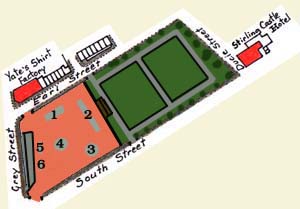 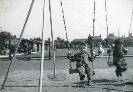  The picture
above wasn't taken in the Sand Park but it might
have been showing as it does a "Witch's Hat"
roundabout like the one located on the South Street
side of the park.
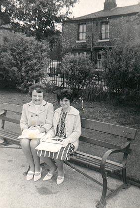
 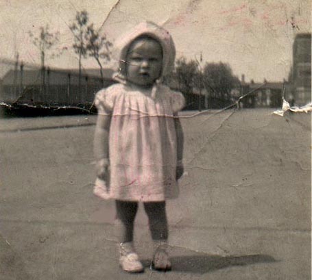 Pamela
Greenhalgh standing on Earl Street outside the Sand
Park in 1950. On the right, further down the street
you can see Yate's Shirt Factory. The photograph was
generously donated by Pamela Pugh
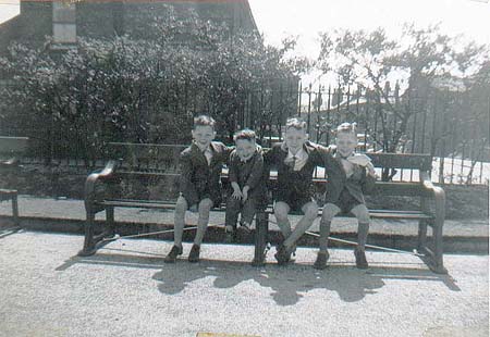  The photograph, above, donated by Vivianne Wainwright, was taken in the park during Whit Week in 1951. As a young child I spent
many happy hours at the park. We took bread
wrappers with us to grease up the slide and
usually ended up falling on our bums after
sliding right off the end. We raised the ire
of the Parkie by trying to take a short cut
back up the slide rather than using the
stairs, trying to wrap the chains of the
swing around the top crossbar or getting the
"witch's hat" rocking back and forth rather
than going around.
***************** The other
end of the park, separated by a fence that ran the
width of the park, catered for an older generation
because it featured two bowling greens. One
of the greens was converted later on into a
putting green. When I was older, my Dad brought
me to the park to learn how to play bowls. I can
still smell the bowls shed -- that wonderful
aroma of oiled woods. Then, whilst I was at
Ardwick Tech, playing a game of bowls at lunch
time became a favourite activity, although on
occasion kids fell foul of the attendant for
sending off rockets across the green to crash
into the gutter and the side boards.
 *******************************
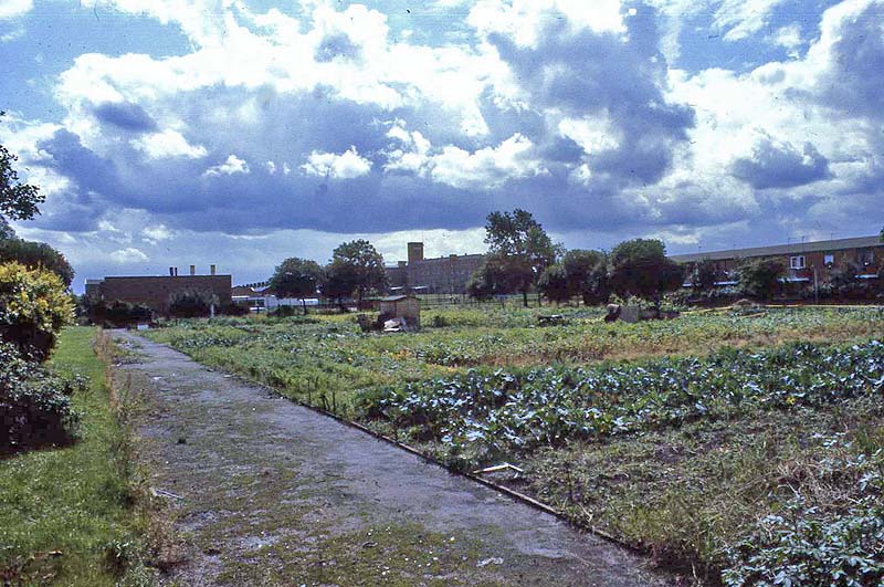
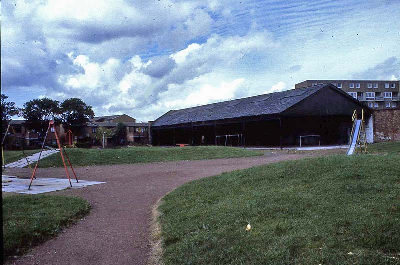
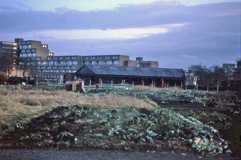
When I returned to the site
in the 1970s the playground and the shed were
still there but the bowling and putting greens
had been converted into allotments. In the
image below you can see Fort Ardwick beyond the
shed.
 Below you
can see the Dillon Street end of the park with
the Daisy Mill in the distance, beyond the
allotments.
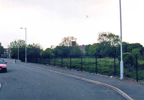
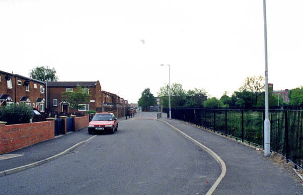
By 2000 little
remained. The shed and the playground were
gone. The railings remained and inside was
a rather nondescript piece of grass.
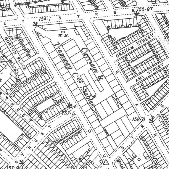
  ************************** Before it was a Park The Manchester Carriage and
Tramway Company provided a horse-drawn tram
service across Manchester and Salford from 1880
until 1903. The company operated
515 trams using 5,244 horses that were
housed in 19 depots across the region.
One of those depots was located on Grey Street in
Longsight, as you can see on the map below. It
occupied the site of the Sand Park of my childhood
years and today's Wonderland Park. It is
possible, perhaps likely, that the shed at the end
of the Sand Park was one last remnant of that depot.
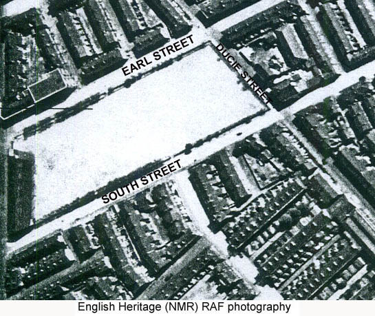
 After the stables closed, the
area was made available as a recreation ground
with a shale surface but with no facilities
beyond the open shed at the Grey Street end,
as you can see in the aerial photograph below
taken in the 1940s.
 |